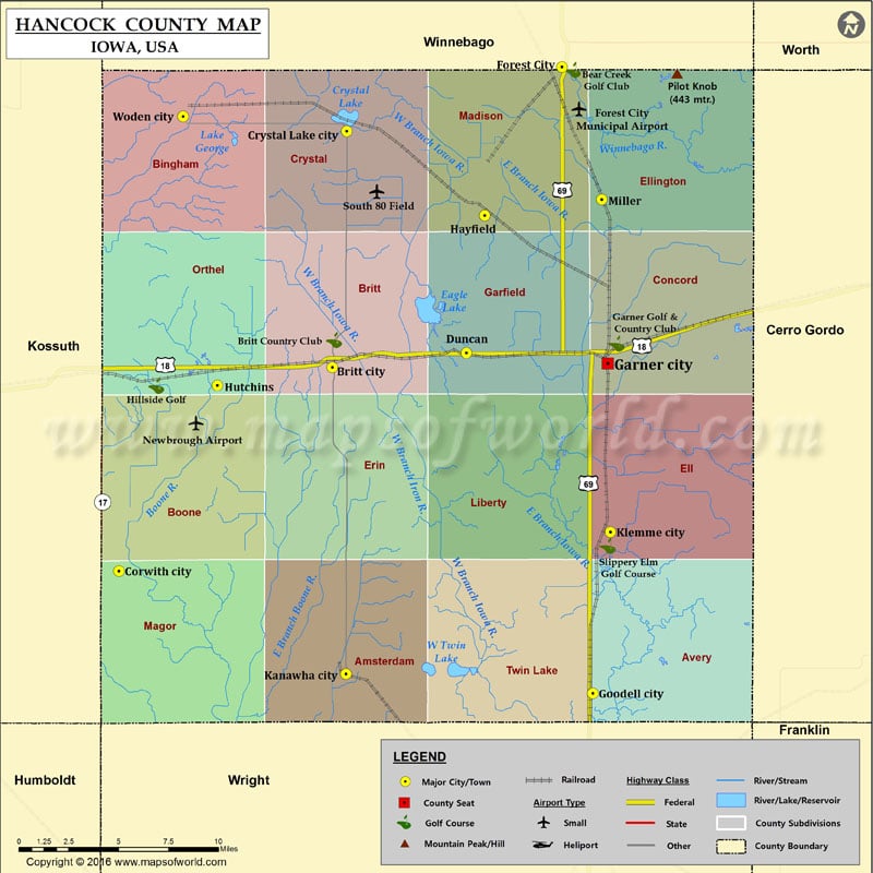
Mountain Peaks in Hancock County
| Mountain Peak/Hill | Elevation [Meter] |
|---|---|
| Pilot Knob | 443 |
More Maps of Hancock County
Airports in Hancock County
| Airport Name |
|---|
| Forest City Municipal Airport |
| Newbrough Airport |
| South 80 Field |
Cities in Hancock County
| City | Population | Latitude | Longitude |
|---|---|---|---|
| Britt city | 2069 | 43.097498 | -93.803159 |
| Corwith city | 309 | 42.989 | -93.958079 |
| Crystal Lake city | 250 | 43.222978 | -93.792707 |
| Duncan | 131 | 43.105138 | -93.705898 |
| Forest City city | 4151 | 43.256969 | -93.636412 |
| Garner city | 3129 | 43.099536 | -93.603298 |
| Goodell city | 139 | 42.92373 | -93.614062 |
| Hayfield | 43 | 43.1781 | -93.69253 |
| Hutchins | 28 | 43.08778 | -93.88657 |
| Kanawha city | 652 | 42.934178 | -93.793244 |
| Klemme city | 507 | 43.009773 | -93.601322 |
| Miller | 60 | 43.186712 | -93.607707 |
| Woden city | 229 | 43.230788 | -93.911424 |
Golf Courses in Hancock County
| Name of Golf Course | Latitude | Longitude |
|---|---|---|
| Bear Creek Golf Club-Forest City | 43.255425 | -93.628517 |
| Britt Country Club-Britt | 43.111887 | -93.80184 |
| Garner Golf & Country Club-Garner | 43.11016 | -93.596727 |
| Hillside Golf-Wesley | 43.08755 | -93.930799 |
| Slippery Elm Golf Course-Klemme | 43.00242 | -93.603219 |
 Wall Maps