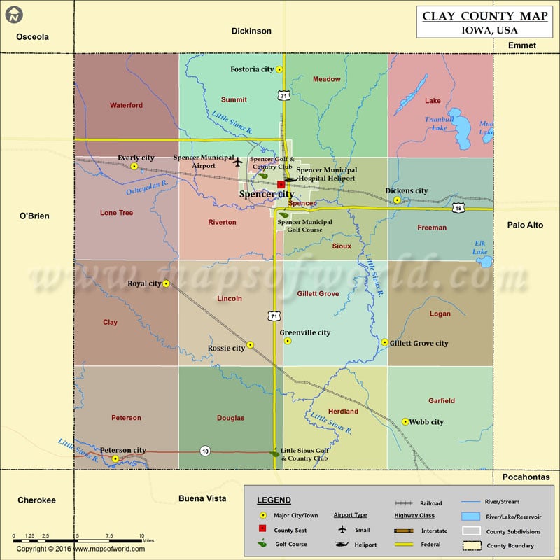
Airports in Clay County
| Airport Name |
|---|
| Spencer Municipal Airport |
| Spencer Municipal Hospital Heliport |
More Maps of Clay County
Cities in Clay County
| City | Population | Latitude | Longitude |
|---|---|---|---|
| Dickens city | 185 | 43.133827 | -95.022192 |
| Everly city | 603 | 43.161769 | -95.319969 |
| Fostoria city | 231 | 43.241837 | -95.155779 |
| Gillett Grove city | 49 | 43.015705 | -95.036282 |
| Greenville city | 75 | 43.016913 | -95.146274 |
| Peterson city | 334 | 42.918847 | -95.341146 |
| Rossie city | 70 | 43.013651 | -95.188566 |
| Royal city | 446 | 43.064354 | -95.283806 |
| Spencer city | 11233 | 43.146523 | -95.153539 |
| Webb city | 141 | 42.949771 | -95.013016 |
Golf Courses in Clay County
| Name of Golf Course | Latitude | Longitude |
|---|---|---|
| Little Sioux Golf & Country Club-Sioux Rapids | 42.924545 | -95.161219 |
| Spencer Golf & Country Club-Spencer | 43.155591 | -95.174081 |
| Spencer Municipal Golf Course-Spencer | 43.123112 | -95.150662 |
 Wall Maps