Pennsylvania Railway Network
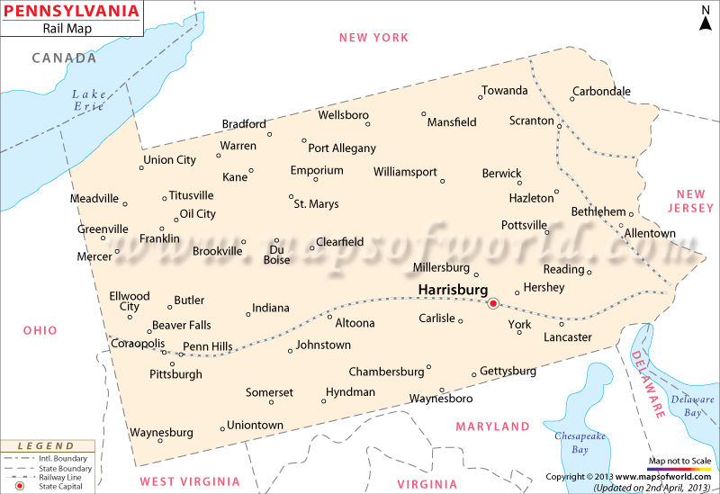
The Pennsylvania Railway Map points out the significant train routes which link the near and far destinations of the state. The Pennsylvania state map is also known to indicate the extensive railway routes of the state.
In 1827, Pennsylvania’s first railroad organization was formed and, in 1828, the first rail line of the state linked Columbia with Philadelphia. In the later years of 1834, 1838, 1839, 1846 and 1855, Philadelphia was connected with Germantown, New Jersey, New York City, Reading, Trenton and Lehigh Valley.
In 1852, Pennsylvania Railroad started operating trains in Pittsburgh. With trackways connecting Buffalo, St. Louis, New York, Chicago and Washington Pennsylvania emerged as a prominent railroad facilitator in the following years.Apart from commuter trains, the Lehigh Valley and Reading railroads of Pennsylvania support the freight carriage system of the Middle Atlantic zone.
Equipped with ten 581 mile long rail lines, as per a 2000 survey, Pennsylvania is served by 60 railroad organizations. Amtrak, a major railway service provider, offers 100 trains to different parts of Pennsylvania. Towns such as Harrisburg, Pittsburgh, Altoona, Lancaster, Allentown and many others, intersected by the rail routes of Pennsylvania, are clearly highlighted in the Railway Map of the State.
 Wall Maps