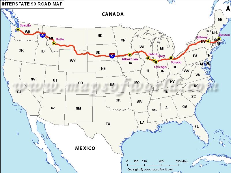
About USA Interstate 90
The I-90 is the longest one in the interstate highway system network covering 3,020 miles (4,861 km).
This coast-to-coast highway connects Boston on the east with Seattle on the west. It crosses the continental divide at Homestake Pass just east of Butte in the state of Montana.
Major Cities Covered
The I-90 covers major cities such as Boston, Albany, Buffalo,Cleveland, Chicago, Seattle. It also connects other cities such as Springfield, Syracuse, Erie, Rockford, Madison, Wisconsin, Billings, and Spokane.
Attractions
There are several sites that you must visit en route I-90. The Wall Drug is a pleasurable stop you might want to consider. You can relish the coffee, free ice water, and good donuts. Commuters can exit from I-90 (exits 110 and 131) and check out the Badlands National Park. Other parks to check out are Buffalo Gap National Park and Yellowstone National Park.
Every year, millions of people pull off I-90 (exit 332) to witness the all-time ultimate roadside attraction, the Corn Palace. You should not give this one a miss, a halt at least for a picture is a must. At a bend on the Missouri River, Framboise Island has several hiking trails and rich wildlife. Devils Tower is certainly awe-inspiring, even more than what you find in the movies. You first see it from miles away as a huge monolith poking over the rolling hills of eastern Wyoming. As you get closer, you can make out the tubes of rock that give it the appearance of a monstrous pipe organ.
If you are a history lover, there are quite a few places you can relish along your journey. Visit Delta-09 Missile Silo, Akta Lakota Museum, and Cultural Center, Lewis and Clark Information Center, South Dakota Cultural and Heritage Center. There are plenty of lodging options along Interstate highway that you can consider for your stops.
Equipped with a
US interstate highway map, you are ready to witness splendid scenic beauty and monuments during your road trip along the US highway I-90.
Route of Interstate Highway No.90 |
|---|
| State | Entry Point | Exit Point | Length |
|---|
| Washington | Seattle, WA | Idaho state line | 296.92 mi (477.85 km) |
| Idaho | Washington state line | Montana state line | 73.888 mi (118.911 km) |
| Montana | Idaho state line | Wyoming state line | 554.10 mi (891.74 km) |
| Wyoming | Montana state line | South Dakota state line | 208.80 mi (336.03 km) |
| South Dakota | Wyoming state line | Minnesota state line | 412.76 mi (664.27 km) |
| Minnesota | South Dakota state line | Wisconsin state line | 275.70 mi (443.70 km) |
| Wisconsin | Minnesota state line | Illinois state line | 187.13 mi (301.16 km) |
| Illinois | Wisconsin state line | Indiana Toll Road at Indiana state line | 107.82 mi (173.52 km) |
| Indiana Toll Road | Chicago Skyway at Illinois state line | Ohio Turnpike at Ohio state line | 156.28 mi (251.51 km) |
| Ohio | Indiana Toll Road at Indiana state line | Pennsylvania state line | 244.75 mi (393.89 km) |
| Pennsylvania | Ohio state line | New York Thruway at New York state line | 46.297 mi (74.508 km) |
| New York | North East, PA | Mass Pike in Stockbridge, MA | 385.88 mi (621.01 km) |
| Massachusetts Turnpike | Berkshire Connector in Canaan, NY | Boston | 138.10 mi (222.25 km) |
| Total Length | | | 3,020.54 mi (4,861.09 km) |
