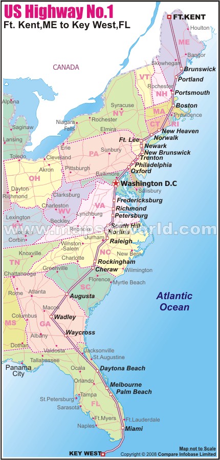
US Route 1 Map
Route 1 From Ft. Kent, ME to Key West, FL
Disclaimer |
×
Disclaimer : All efforts have been made to make this image accurate. However MapSherpa, Inc, its directors and employees do not own any responsibility for the correctness or authenticity of the same.
US Route 1 Major Junctions | |
---|---|
NH No. | 1 |
Existed | 1926 - present |
Starting point | Whitehead Street / Fleming Street in Key West, FL |
End Point | Route 161 in Clair, New Brunswick, Canada (CA) |
Length | 2,369 mi (3,813 km) |
Major Junctions | Whitehead Street / Fleming Street in Key West, FL I-10 in Jacksonville, FL I-16 near Swainsboro, GA I-20 near Aiken, SC I-26 / I-20 in Columbia, SC I-40 in Cary, NC I-64 in Richmond, VA I-83 in Baltimore, MD I-76 in Philadelphia, PA I-87 in New York City, NY I-90 / I-93 in Boston, MA I-95 in Houlton, ME Route 161 in Clair, New Brunswick, Canada (CA) |
State | Florida, Georgia, South Carolina, North Carolina, Virginia, District of Columbia, Maryland, Pennsylvania, New Jersey, New York, Connecticut, Rhode Island, Massachusetts, New Hampshire, Maine |
USA Highway Maps |
---|