- North Carolina Counties - North Carolina County Map, Map of North Carolina Counties
- Major Cities of North Carolina - Raleigh, Charlotte
- Neighbouring States - Virginia, Tennessee, Georgia, South Carolina
- Regional Maps - Map of USA
- Other North Carolina Maps - North Carolina Map, North Carolina Physical Map, North Carolina Airports Map, North Carolina Lat Long Map, North Carolina Zip Code Map, North Carolina Area Code Map, North Carolina National Parks Map
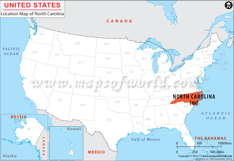
North Carolina state occupies total land area of 126,504 square kilometer and inland water area of 9,909 square kilometer. The latitude and longitude for the state are 35.5° N, 80.0° W. North Carolina shares its northern border with Virginia and southern border with Georgia and South Carolina. The eastern front of the state is bordered by the Atlantic Ocean, while the western front of North Carolina is surrounded by Tennessee. The boundary line of North Carolina is 2,044 kilometer long.
The state has 484 kilometer long coastline and 5,432 kilometer long tidal shoreline. The Outer Banks of North Carolina along the Atlantic Ocean are bordered by many islands. The east-west stretch of North Carolina is 810 kilometer and the north-south stretch of the state is 301 kilometer.
The country of North Carolina is in the North America continent and the latitude and longitude for the country are 35.6006° N, 79.4508° W. View Map of North Carolina for more information.
Facts About North Carolina |
|
|---|---|
| State Name | North Carolina |
| Country | United States (USA) |
| Continent | North America |
| Capital | Raleigh |
| Largest city | Charlotte |
| Area | 53,819 sq mi (139,390 km2) |
| Population | 9,943,964 (2014 est) |
| Lat Long | 35° 30′ 0″ N, 80° 0′ 0″ W |
| Official Language | None (English de facto) |
| Calling Code | Raleigh- 00 1 919 X , Charlotte- 00 1 704 X |
| Time Zone | Eastern: UTC -5/-4 |
| Airport | 9- Airports (Commercial Service) |
| Neighbour State | South Carolina, Georgia, Virginia, Tennessee |
| Internet TLD | |
| Currency | United State Dollar (USD) |
 Wall Maps