US Interstate 77 Map
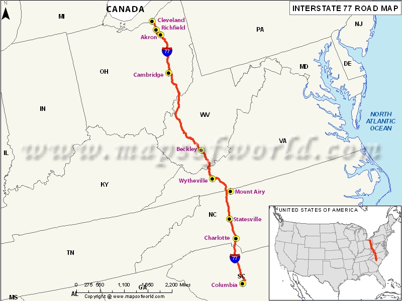
Description:Map depicts US Interstate 77 (I-77) route from Columbia, South Carolina to Cleveland, Ohio. | Disclaimer |
×
Disclaimer : All efforts have been made to make this image accurate. However MapSherpa, Inc, its directors and employees do not own any responsibility for the correctness or authenticity of the same.
US Interstate 77 Highway Map
The Interstate 77 (or I-77) is a US interstate highway that connects the eastern Great Lakes area to the Southeast region. The freeway begins at the southern side of Columbia, transverses through the terrains of West Virginia to the states of Ohio and North Carolina. The northern terminus of the Interstate 77 is in Cleveland at the place where it meets I-90.The southern terminus of I-77 is in Columbia where it meets I-26.
Through the city of Akron, I-77 shares a 3-mile overlap with I-76. If you are traveling along the full length of I-77, you will cover approximately 610 miles (982 km).
States Covered
The US Interstate Highway Map shows that I-77 connects the states of Ohio, West Virginia, Virginia, North Carolina, and South Carolina. Interstate 77 first appeared in the US highway and interstate system in the year 1957.
Major Cities covered by I-77 Highway
This Interstate system meanders through various terrains and major towns. The major towns located along the I-77 route include Cleveland, Akron, Beckley, Charleston, Wytheville, Charlotte, and Columbia. The interstate highway twists and turns in and out of city centers and stops at different intersections.
Tourist Attractions along I-77 Highway
- The Camp Creek State Park and Forest, located just 2 miles off I-77 at the exit 20, is known for its waterfalls and camping experiences.
- The Wolf Run State Park is found on the mountainous region of southeast Ohio. The clean and cool waters and the scenic views offer a quiet retreat during travels.
- The Stone Mountain State Park is a major attraction for the travelers along the I-77 who enjoy hiking, fishing, horse riding, and camping. The park is located off I-77 in the northwest corner of North Carolina.
Route of Interstate Highway No.77 |
---|
State | Entry Point | Exit Point | Length |
---|---|---|---|
South Carolina | Cayce, SC | NC state line | 91.2 mi (146.8 km) |
North Carolina | SC line near Fort Mill, SC | line near Mount Airy | 105.7 mi (170.1 km) |
Virginia | Mount Airy, NC | near Bluefield, WV | 66.27 mi (106.65 km) |
West Virginia | Virginia state line | Ohio state line | 187.21 mi (301.29 km) |
Ohio | West Virginia state line | Cleveland | 163.03 mi (262.37 km) |
Total Length | 613.41 mi (987.19 km) |
US Interstates Highways Route Map |
---|