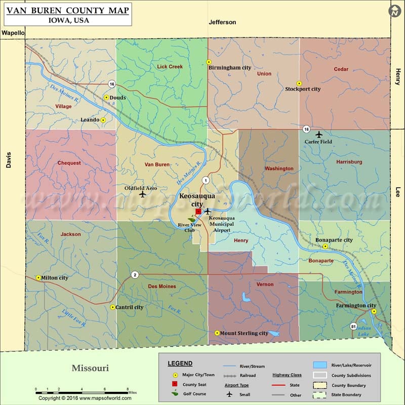
Airports in Van Buren County
| Airport Name |
|---|
| Carter Field |
| Keosauqua Municipal Airport |
| Oldfield Aero |
Cities in Van Buren County
| City | Population | Latitude | Longitude |
|---|---|---|---|
| Birmingham city | 448 | 40.877708 | -91.947259 |
| Bonaparte city | 433 | 40.701174 | -91.800522 |
| Cantril city | 222 | 40.642841 | -92.068466 |
| Douds | 152 | 40.843848 | -92.076387 |
| Farmington city | 664 | 40.638854 | -91.739014 |
| Keosauqua city | 1006 | 40.734689 | -91.960534 |
| Leando | 115 | 40.822129 | -92.080524 |
| Milton city | 443 | 40.671185 | -92.16215 |
| Mount Sterling city | 36 | 40.618104 | -91.936738 |
| Stockport city | 296 | 40.857286 | -91.83336 |
Golf Courses in Van Buren County
| Name of Golf Course | Latitude | Longitude |
|---|---|---|
| River View Club-Keosauqua | 40.727852 | -91.969068 |
 Wall Maps