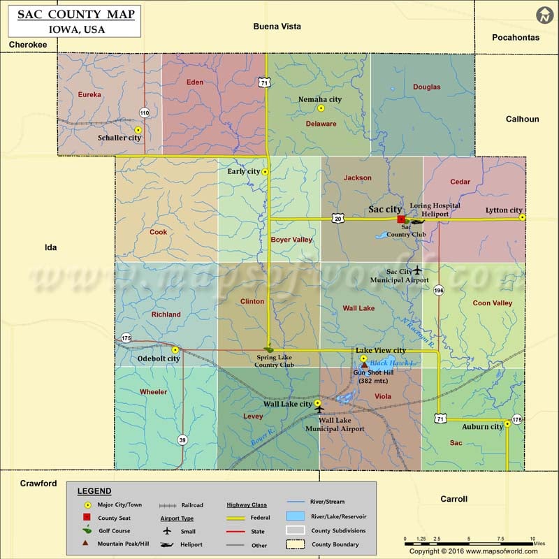
Mountain Peaks in Sac County
| Mountain Peak/Hill | Elevation [Meter] |
|---|---|
| Gun Shot Hill | 382 |
Airports in Sac County
| Airport Name |
|---|
| Loring Hospital Heliport |
| Sac City Municipal Airport |
| Wall Lake Municipal Airport |
Cities in Sac County
| City | Population | Latitude | Longitude |
|---|---|---|---|
| Auburn city | 322 | 42.249569 | -94.877726 |
| Early city | 557 | 42.461427 | -95.152376 |
| Lake View city | 1142 | 42.304689 | -95.040777 |
| Lytton city | 315 | 42.423303 | -94.860499 |
| Nemaha city | 85 | 42.514952 | -95.08886 |
| Odebolt city | 1013 | 42.311793 | -95.254235 |
| Sac City city | 2220 | 42.421696 | -94.997911 |
| Schaller city | 772 | 42.496531 | -95.296271 |
| Wall Lake city | 819 | 42.267186 | -95.092779 |
Golf Courses in Sac County
| Name of Golf Course | Latitude | Longitude |
|---|---|---|
| Sac Country Club-Sac City | 42.421825 | -94.994129 |
| Spring Lake Country Club-Wall Lake | 42.313582 | -95.148335 |
 Wall Maps