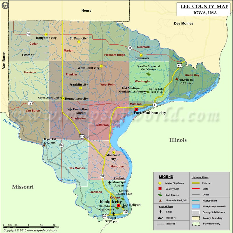
Mountain Peaks in Lee County
| Mountain Peak/Hill | Elevation [Meter] |
|---|---|
| Bryan Hill | 202 |
| Jollyville Hill | 162 |
More Maps of Lee County
- Lee County Map, South Carolina
- Lee County Map, Alabama
- Lee County Map, Florida
- Lee County Map, North Carolina
- Lee County Map, Georgia
Airports in Lee County
| Airport Name |
|---|
| Bickel STOLport |
| Donnellson Airport |
| Fort Madison Municipal Airport |
| Kah Heliport |
| Keokuk Municipal Airport |
Cities in Lee County
| City | Population | Latitude | Longitude |
|---|---|---|---|
| Denmark | 423 | 40.738508 | -91.338115 |
| Donnellson city | 912 | 40.644154 | -91.561585 |
| Fort Madison city | 11051 | 40.619873 | -91.351913 |
| Franklin city | 143 | 40.666965 | -91.511803 |
| Houghton city | 146 | 40.783666 | -91.610809 |
| Keokuk city | 10780 | 40.40956 | -91.403029 |
| Montrose city | 898 | 40.526117 | -91.416541 |
| St. Paul city | 129 | 40.767828 | -91.516434 |
| West Point city | 966 | 40.714963 | -91.452281 |
Golf Courses in Lee County
| Name of Golf Course | Latitude | Longitude |
|---|---|---|
| Elks Fairview Golf Course-Keokuk | 40.405902 | -91.407387 |
| Green Acres Club-Donnellson | 40.646255 | -91.565134 |
| Keokuk Country Club-Keokuk | 40.426317 | -91.391039 |
| Sheaffer Memorial Golf Course-Fort Madison | 40.69867 | -91.317154 |
| Spring Lake Golf Club-Fort Madison | 40.660148 | -91.319949 |
 Wall Maps