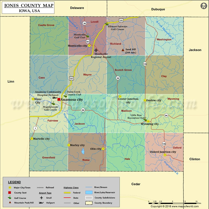
Mountain Peaks in Jones County
| Mountain Peak/Hill | Elevation [Meter] |
|---|---|
| Chimney Rock | 258 |
More Maps of Jones County
Airports in Jones County
| Airport Name |
|---|
| Anamosa Community Hospital Heliport |
| Monticello Regional Airport |
Cities in Jones County
| City | Population | Latitude | Longitude |
|---|---|---|---|
| Anamosa city | 5533 | 42.109284 | -91.275875 |
| Center Junction city | 111 | 42.115773 | -91.090366 |
| Martelle city | 255 | 42.020444 | -91.357764 |
| Monticello city | 3796 | 42.23042 | -91.183729 |
| Morley city | 115 | 42.006028 | -91.245872 |
| Olin city | 698 | 41.997611 | -91.141717 |
| Onslow city | 197 | 42.107306 | -91.015255 |
| Oxford Junction city | 496 | 41.983723 | -90.954097 |
| Stone City | 192 | 42.110067 | -91.354292 |
| Wyoming city | 515 | 42.059721 | -91.00511 |
Golf Courses in Jones County
| Name of Golf Course | Latitude | Longitude |
|---|---|---|
| Fawn Creek Country Club-Anamosa | 42.1177 | -91.256779 |
| Fillmore Fairways Golf Course-Cascade | 42.28048 | -91.131239 |
| Little Bear Recreation Club-Wyoming | 42.06443 | -91.014505 |
| Monticello Golf Club-Monticello | 42.253135 | -91.189894 |
| Wapsipinicon Golf Course-Anamosa | 42.100449 | -91.293152 |
 Wall Maps