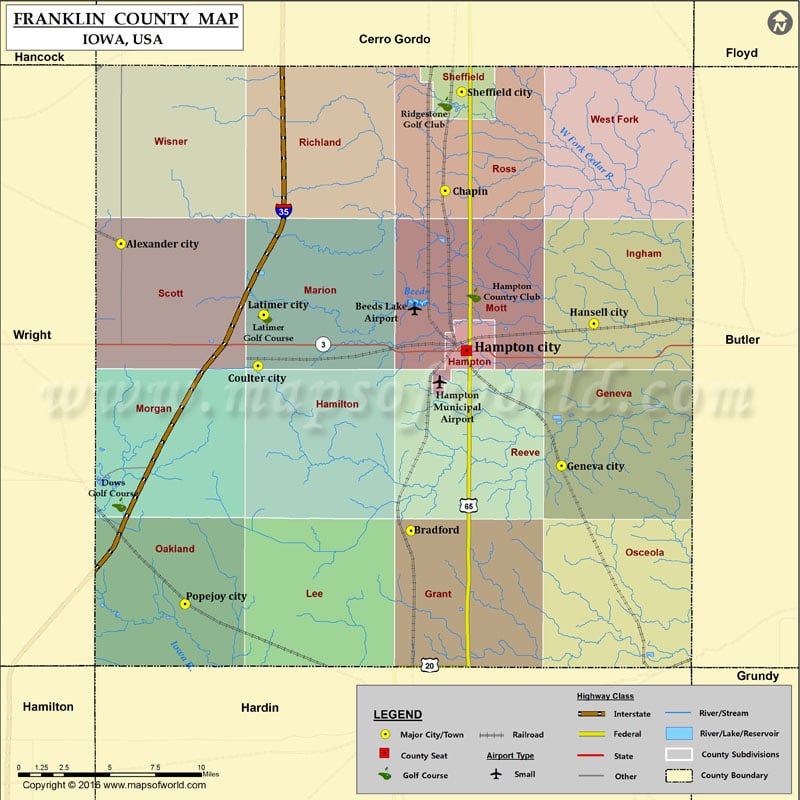
Airports in Franklin County
| Airport Name |
|---|
| Beeds Lake Airport |
| Hampton Municipal Airport |
More Maps of Franklin County
- Franklin County Map, Vermont
- Franklin County Map, Nebraska
- Franklin County Map, Alabama
- Franklin County Map, Florida
- Franklin County Map, New York
- Franklin County Map, North Carolina
- Franklin County Map, Texas
- Franklin County Map, Tennessee
- Franklin County Map, Washington
- Franklin County Map, Georgia
Cities in Franklin County
| City | Population | Latitude | Longitude |
|---|---|---|---|
| Alexander city | 175 | 42.80442 | -93.478647 |
| Bradford | 99 | 42.636706 | -93.248948 |
| Chapin | 87 | 42.835312 | -93.221982 |
| Coulter city | 281 | 42.73312 | -93.370047 |
| Geneva city | 165 | 42.674798 | -93.129766 |
| Hampton city | 4461 | 42.742006 | -93.204966 |
| Hansell city | 98 | 42.75775 | -93.104094 |
| Latimer city | 507 | 42.762884 | -93.3656 |
| Popejoy city | 79 | 42.593881 | -93.427823 |
| Sheffield city | 1172 | 42.89288 | -93.208697 |
Golf Courses in Franklin County
| Name of Golf Course | Latitude | Longitude |
|---|---|---|
| Dows Golf Course-Dows | 42.652113 | -93.48004 |
| Hampton Country Club-Hampton | 42.774458 | -93.199088 |
| Latimer Golf Course-Latimer | 42.762065 | -93.364549 |
| Ridgestone Golf Club-Sheffield | 42.88593 | -93.221839 |
 Wall Maps