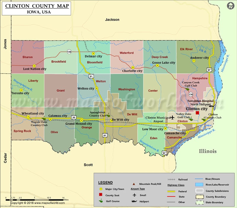
Airports in Clinton County
| Airport Name |
|---|
| Clinton Municipal Airport |
| Samaritan Hospital North Heliport |
More Maps of Clinton County
Cities in Clinton County
| City | Population | Latitude | Longitude |
|---|---|---|---|
| Andover city | 103 | 41.979923 | -90.252985 |
| Calamus city | 439 | 41.826494 | -90.760015 |
| Camanche city | 4448 | 41.792759 | -90.276678 |
| Charlotte city | 394 | 41.96213 | -90.468206 |
| Clinton city | 26885 | 41.843436 | -90.240789 |
| De Witt city | 5322 | 41.822417 | -90.543844 |
| Delmar city | 525 | 41.998801 | -90.607968 |
| Goose Lake city | 240 | 41.967883 | -90.381762 |
| Grand Mound city | 642 | 41.823271 | -90.650158 |
| Lost Nation city | 446 | 41.966599 | -90.816717 |
| Low Moor city | 288 | 41.802344 | -90.354213 |
| Toronto city | 124 | 41.902889 | -90.862757 |
| Welton city | 165 | 41.90768 | -90.596095 |
| Wheatland city | 764 | 41.832892 | -90.837872 |
Golf Courses in Clinton County
| Name of Golf Course | Latitude | Longitude |
|---|---|---|
| Canyon Creek Golf Club-Clinton | 41.907448 | -90.276874 |
| Clinton Country Club-Clinton | 41.82732 | -90.218991 |
| Springbrook Country Club-de Witt | 41.837681 | -90.556012 |
| Valley Oaks Golf Club-Clinton | 41.827688 | -90.264257 |
| Wapsie Oaks Country Club-Calamus | 41.829547 | -90.783164 |
 Wall Maps