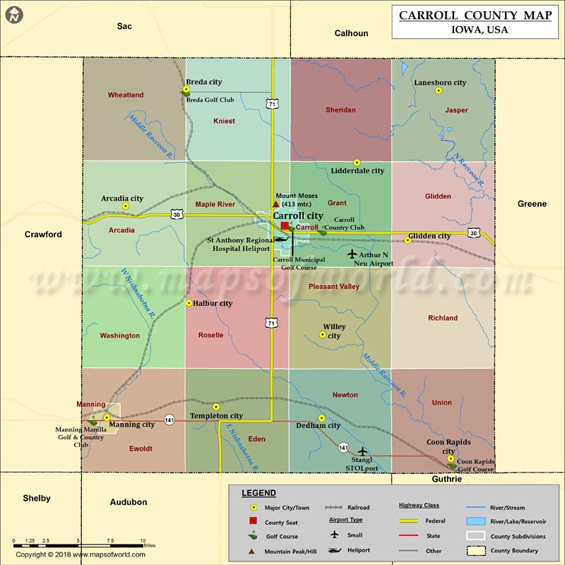
Mountain Peaks in Carroll County
| Mountain Peak/Hill | Elevation [Meter] |
|---|---|
| Mount Moses | 413 |
More Maps of Carroll County
Airports in Carroll County
| Airport Name |
|---|
| Arthur N Neu Airport |
| St Anthony Regional Hospital Heliport |
| Stangl STOLport |
Cities in Carroll County
| City | Population | Latitude | Longitude |
|---|---|---|---|
| Arcadia city | 484 | 42.086197 | -95.043192 |
| Breda city | 483 | 42.183967 | -94.975046 |
| Carroll city | 10103 | 42.069735 | -94.864689 |
| Coon Rapids city | 1305 | 41.874769 | -94.678454 |
| Dedham city | 266 | 41.908731 | -94.823237 |
| Glidden city | 1146 | 42.057631 | -94.726665 |
| Halbur city | 246 | 42.005124 | -94.972048 |
| Lanesboro city | 121 | 42.18266 | -94.692169 |
| Lidderdale city | 180 | 42.122495 | -94.78367 |
| Manning city | 1500 | 41.909212 | -95.064233 |
| Templeton city | 362 | 41.918114 | -94.941568 |
| Willey city | 88 | 41.978746 | -94.822365 |
Golf Courses in Carroll County
| Name of Golf Course | Latitude | Longitude |
|---|---|---|
| Breda Golf Club-Breda | 42.18156 | -94.976479 |
| Carroll Country Club-Carroll | 42.06567 | -94.823107 |
| Carroll Municipal Golf Course-Carroll | 42.068937 | -94.863842 |
| Coon Rapids Golf Course-Coon Rapids | 41.870435 | -94.677479 |
| Manning Manilla Golf & Country Club-Manning | 41.90663 | -95.080589 |
 Wall Maps