1.5K
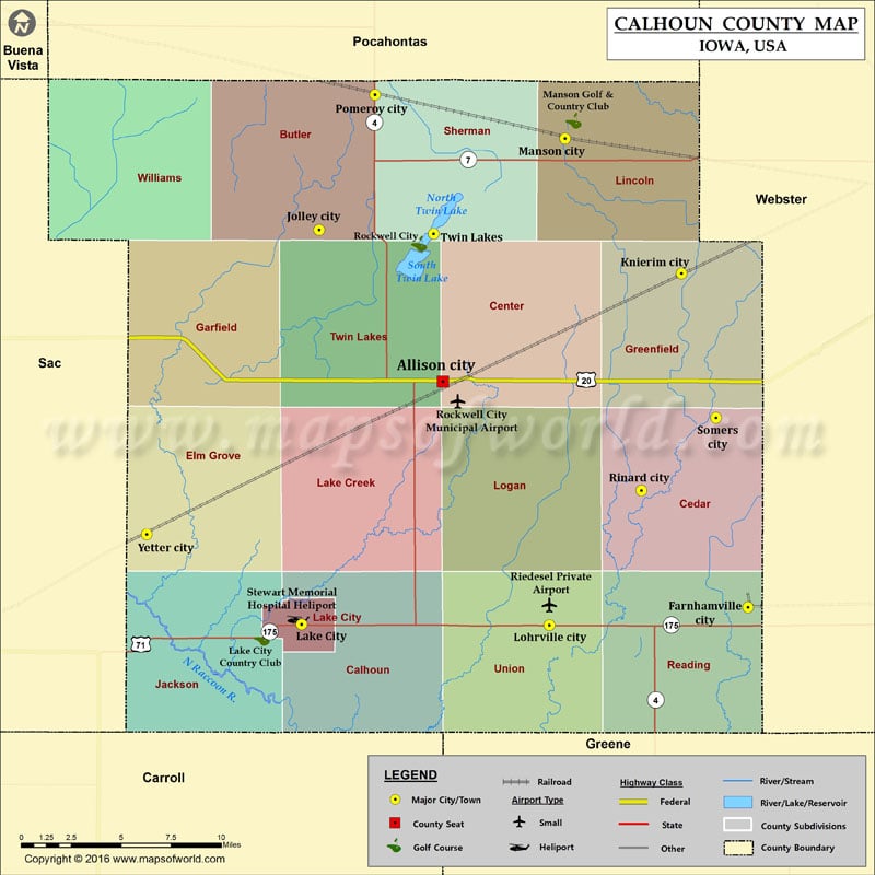
Airports in Calhoun County
| Airport Name |
|---|
| Riedesel Private Airport |
| Rockwell City Municipal Airport |
| Stewart Memorial Hospital Heliport |
More Maps of Calhoun County
- Calhoun County Map, South Carolina
- Calhoun County Map, Alabama
- Calhoun County Map, Florida
- Calhoun County Map, Texas
- Calhoun County Map, Georgia
Cities in Calhoun County
| City | Population | Latitude | Longitude |
|---|---|---|---|
| Farnhamville city | 371 | 42.276784 | -94.407793 |
| Jolley city | 41 | 42.479448 | -94.71826 |
| Knierim city | 60 | 42.45614 | -94.455937 |
| Lake City city | 1727 | 42.267637 | -94.731046 |
| Lohrville city | 368 | 42.267173 | -94.551598 |
| Manson city | 1690 | 42.528385 | -94.540154 |
| Pomeroy city | 662 | 42.55195 | -94.67782 |
| Rinard city | 52 | 42.339613 | -94.48493 |
| Rockwell City city | 1709 | 42.398164 | -94.62888 |
| Somers city | 113 | 42.378713 | -94.430956 |
| Twin Lakes | 334 | 42.477408 | -94.635439 |
| Yetter city | 34 | 42.31613 | -94.843166 |
Golf Courses in Calhoun County
| Name of Golf Course | Latitude | Longitude |
|---|---|---|
| Lake City Country Club-Lake City | 42.26044 | -94.759784 |
| Manson Golf & Country Club-Manson | 42.53796 | -94.534009 |
| Twin Lakes Golf Course-Rockwell City | 42.472095 | -94.64594 |
 Wall Maps