1.1K
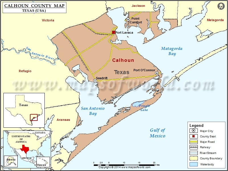
Check this Texas County Map to locate all the state’s counties in Texas Map.
Mountain Peaks in Calhoun County
| Mountain Peak/Hill | Elevation [Meter] |
|---|---|
| Josephine Motte | 1 |
More Maps of Calhoun County
Airports in Calhoun County
| Airport Name |
|---|
| Big Duke’s Place Airport |
| Calhoun County Airport |
| Cig 806 Heliport |
| Green Lake Ranch Airport |
| Hhi-Port O’Connor Heliport |
| Industrial Helicopters Inc Heliport |
| Los Ebanos Ranch Airport |
| Midstream Port O’Connor Heliport |
| Phi Heliport |
| Phi Heliport |
| Port O’Connor Base (Ehi) Heliport |
| Port O’Connor Private Airport |
| Tanner’s Airport |
| Whatley Flying Service Airport |
Cities in Calhoun County
| City | Population | Latitude | Longitude |
|---|---|---|---|
| Point Comfort city | 737 | 28.671463 | -96.559088 |
| Port Lavaca city | 12248 | 28.618065 | -96.627837 |
| Port O’Connor | 1253 | 28.446341 | -96.420512 |
| Seadrift city | 1364 | 28.414446 | -96.715812 |
Golf Courses in Calhoun County
| Name of Golf Course | Latitude | Longitude |
|---|---|---|
| Hatch Bend Country Club-Port Lavaca | 28.58665 | -96.701259 |
 Wall Maps