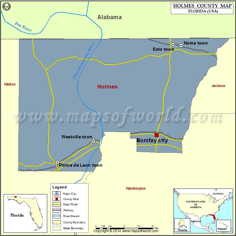
Check this Florida County Map to locate all the state’s counties in Florida Map.
Mountain Peaks in Holmes County
| Mountain Peak/Hill | Elevation [Meter] |
|---|---|
| Balcom Hill | 73 |
| Blackburn Hill | 64 |
| Brown Hill | 65 |
| Brownell Hill | 80 |
| Bunker Hill | 75 |
| Coates Hill | 70 |
| Corbett Hill | 76 |
| Crater Hill | 66 |
| Hudson Hill | 86 |
| Jackson Hill | 71 |
| Long Pond Hill | 47 |
| Marsh Hill | 71 |
| McIntosh Hill | 73 |
| Mill Spring Hill | 42 |
| Morrison Hill | 54 |
| Murphy Hill | 73 |
| Nancy Padgett Hill | 71 |
| Old Hammock Hill | 38 |
| Reynold Hill | 46 |
| Reynolds Hill | 78 |
| Riley Hill | 73 |
| Saddle Hill | 57 |
| Sheep Hill | 50 |
| Slaughter Hill | 19 |
| Smothers Hill | 65 |
| Stokes Hill | 63 |
| Tate Hill | 81 |
| Taylor Hill | 66 |
| Worley Hill | 55 |
Airports in Holmes County
| Airport Name |
|---|
| Doctors Hospital Heliport |
| Tharpe Airport |
| Tri-County Airport |
Cities in Holmes County
| City | Population | Latitude | Longitude |
|---|---|---|---|
| Bonifay city | 2793 | 30.782761 | -85.684558 |
| Esto town | 364 | 30.981829 | -85.642892 |
| Noma town | 211 | 30.980049 | -85.62235 |
| Ponce de Leon town | 598 | 30.723157 | -85.937401 |
| Westville town | 289 | 30.769661 | -85.846467 |
Golf Courses in Holmes County
| Name of Golf Course | Latitude | Longitude |
|---|---|---|
| Dogwood Lakes Golf Club-Bonifay | 30.857308 | -85.744822 |
 Wall Maps