Interstate 4 Map, USA
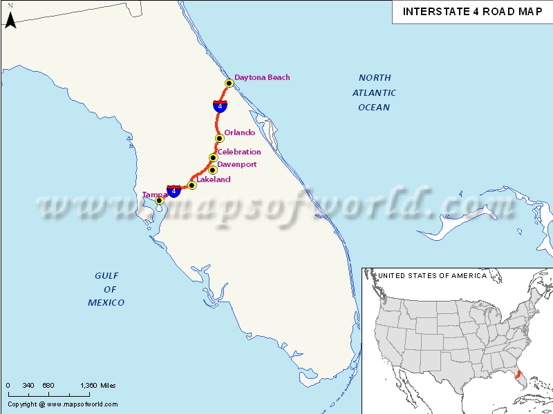
Description:Map depicts US Interstate 4 (I-4) route from Tampa, Florida to Daytona Beach, Florida. | Disclaimer |
×
Disclaimer : All efforts have been made to make this image accurate. However MapSherpa, Inc, its directors and employees do not own any responsibility for the correctness or authenticity of the same.
US Interstate 4 highway Map
Interstate 4, popularly abbreviated as I-4 is a 132.298 mile long i.e. 212.913 km Interstate Highway situated in the US state of Florida. It is located along a southwest-northeast axis from the Interstate 275 in Tampa to the Interstate 95 at Daytona Beach. The entire of Interstate 4 overlaps the entire of State Road 400(SR 400), which further extends from Daytona Beach from the Interstate 95 to the US Highway 1. The Interstate 4 doesn’t have any auxiliary Interstate Highway spurs or loops. But, it definitely intersects multiple expressways, which have been designated as state roads.
Extent of I-4 Highway
Interstate 4 has its 132-mile-long western terminus is with an interchange with the Interstate 275, also known as Malfunction Junction, located near downtown Tampa. Towards the east of this Malfunction Junction, the Interstate 4 passes along the north side of Tampa’s Ybor City district. This Interstate continues east past the Florida State Fairgrounds towards the turbine interchange with the Interstate 75.States and cities along I-4 Highway
- Florida: Deltona, Kissimmee, Lakeland, Orlando, Tampa- St. Petersburg
Restaurants along Interstate-4 Highway
Here is a list of few great restaurants along Interstate-4 Highway:
- Bernini
- Far East Chinese Restaurant
- Soul of Korea
- Chan’s Chinese Restaurant
- El Paraiso Cafe
Attractions along I-4 Highway
Some of the renowned tourist attractions along I-4 Highway include:
- Gameworks
- Ben-Zs Galerie
- Hoffman Porges Art Gallery
- Centro Asturiano De Tampa
- Ybor City State Museum
Route of Interstate Highway No.4 |
---|
State | Entry Point | Exit Point | Length |
---|---|---|---|
Florida | Tampa, FL | Daytona Beach, FL | 132.298 mi (212.913 km) |
Total Length | 132.298 mi (212.913 km) |
US Interstates Highways Route Map |
---|