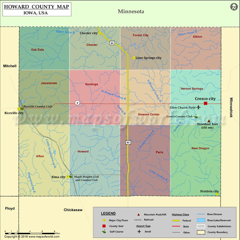
Mountain Peaks in Howard County Mountain Peak/Hill Elevation [Meter] Steamboat Rock 350 More Maps of Howard County Howard County Map, Nebraska Howard County Map, Texas Airports in Howard County Airport…
Mountain Peaks in Howard County
Mountain Peak/Hill
Elevation [Meter]
Steamboat Rock
350
More Maps of Howard County
Airports in Howard County
Airport Name
Ellen Church Field
Cities in Howard County
City
Population
Latitude
Longitude
Chester city
127
43.491844
-92.363951
Cresco city
3868
43.371757
-92.11635
Elma city
546
43.245873
-92.439334
Lime Springs city
505
43.449847
-92.284082
Protivin city
283
43.216428
-92.089145
Riceville city
785
43.362157
-92.554108
Golf Courses in Howard County
Name of Golf Course
Latitude
Longitude
Cresco Country Club-Cresco
43.349731
-92.140012
Maple Heights Golf and Country Club-Elma
43.247556
-92.433529
Riceville Country Club-Riceville
43.363986
-92.547871

 Wall Maps