955
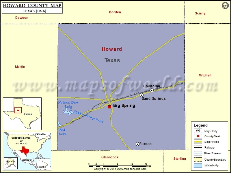
Check this Texas County Map to locate all the state’s counties in Texas Map.
Mountain Peaks in Howard County
| Mountain Peak/Hill | Elevation [Meter] |
|---|---|
| East Gunsight Mountain | 812 |
| Flattop Mountain | 765 |
| Gold Hill | 769 |
| Hayrick Mountain | 797 |
| Rattlesnake Mountain | 769 |
| Scenic Mountain | 844 |
| Signal Mountains | 808 |
| Signal Peak | 813 |
| South Mountain | 845 |
| West Gunsight Mountain | 819 |
| Wildhorse Mountain | 762 |
More Maps of Howard County
Airports in Howard County
| Airport Name |
|---|
| Big Spring Mc Mahon-Wrinkle Airport |
<h2″>Cities in Howard County
| City | Population | Latitude | Longitude |
|---|---|---|---|
| Big Spring city | 27282 | 32.238714 | -101.480158 |
| Coahoma town | 817 | 32.295744 | -101.308822 |
| Forsan city | 210 | 32.110338 | -101.366796 |
| Sand Springs | 835 | 32.279481 | -101.349511 |
Golf Courses in Howard County
| Name of Golf Course | Latitude | Longitude |
|---|---|---|
| Big Spring Country Club-Big Spring | 32.209994 | -101.422683 |
| Comanche Trail Golf Course-Big Spring | 32.246395 | -101.463428 |
 Wall Maps