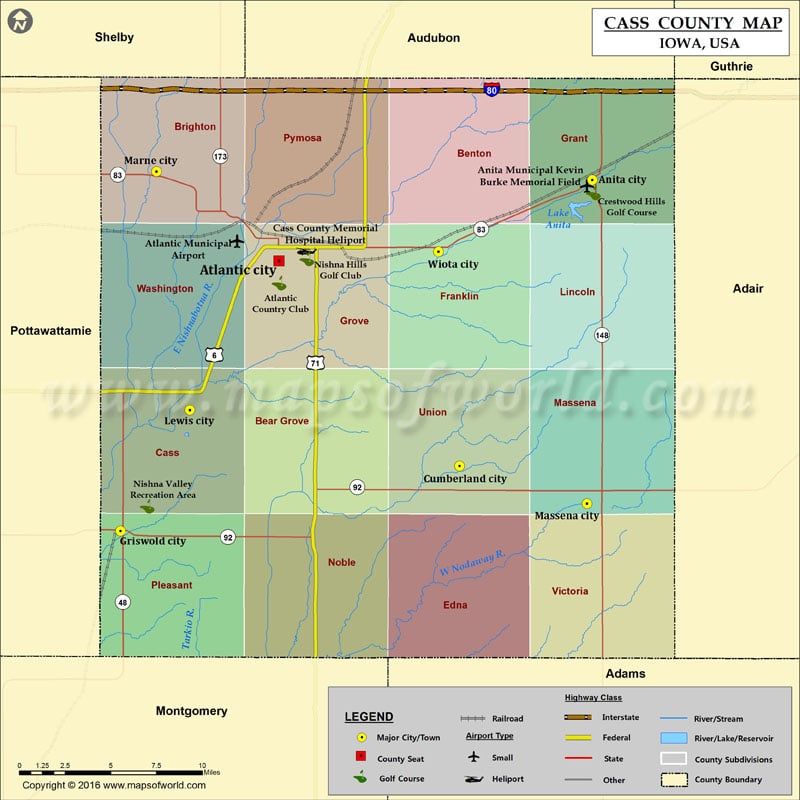
Airports in Cass County Airport Name Anita Municipal Kevin Burke Memorial Field Atlantic Municipal Airport Cass County Memorial Hospital Heliport More Maps of Cass County Cass County Map, North Dakota…
Airports in Cass County
Airport Name
Anita Municipal Kevin Burke Memorial Field
Atlantic Municipal Airport
Cass County Memorial Hospital Heliport
Cities in Cass County
City
Population
Latitude
Longitude
Anita city
972
41.443908
-94.765637
Atlantic City
7112
41.395658
-95.013885
Cumberland city
262
41.273088
-94.87067
Griswold city
1036
41.234297
-95.139278
Lewis city
433
41.306493
-95.084283
Marne city
120
41.448905
-95.110762
Massena city
355
41.250644
-94.76982
Wiota city
116
41.401031
-94.887457
Golf Courses in Cass County
Name of Golf Course
Latitude
Longitude
Atlantic Country Club-Atlantic
41.382319
-95.013668
Crestwood Hills Golf Course-Anita
41.436162
-94.764692
Nishna Hills Golf Club-Atlantic
41.396751
-94.991578
Nishna Valley Recreation Area-Griswold
41.249058
-95.118182

 Wall Maps