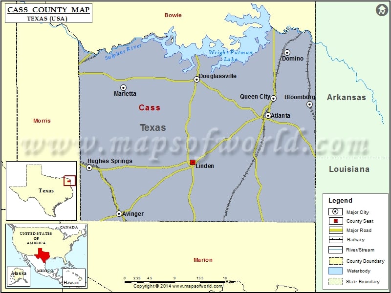
Check this Texas County Map to locate all the state’s counties in Texas Map.
Mountain Peaks in Cass County
| Mountain Peak/Hill | Elevation [Meter] |
|---|---|
| Cusseta Mountains | 191 |
| Donaldson Mountain | 123 |
| Hickory Hill | 141 |
More Maps of Cass County
Airports in Cass County
| Airport Name |
|---|
| Boon/Lovelace Airport |
| Eagle Landing Airport |
| Leroux Airport |
Cities in Cass County
| City | Population | Latitude | Longitude |
|---|---|---|---|
| Atlanta city | 5675 | 33.113585 | -94.167244 |
| Avinger town | 444 | 32.898007 | -94.553267 |
| Bloomburg town | 404 | 33.137797 | -94.059076 |
| Domino town | 93 | 33.250857 | -94.116877 |
| Douglassville town | 229 | 33.191646 | -94.35194 |
| Hughes Springs city | 1760 | 32.998673 | -94.631063 |
| Linden city | 1988 | 33.010954 | -94.362628 |
| Marietta town | 134 | 33.173548 | -94.542531 |
| Queen City city | 1476 | 33.150762 | -94.152447 |
Golf Courses in Cass County
| Name of Golf Course | Latitude | Longitude |
|---|---|---|
| Indian Hills Country Club-Atlanta | 33.11174 | -94.194479 |
| Spring Creek Golf Course-Atlanta | 33.12427 | -94.146319 |
 Wall Maps