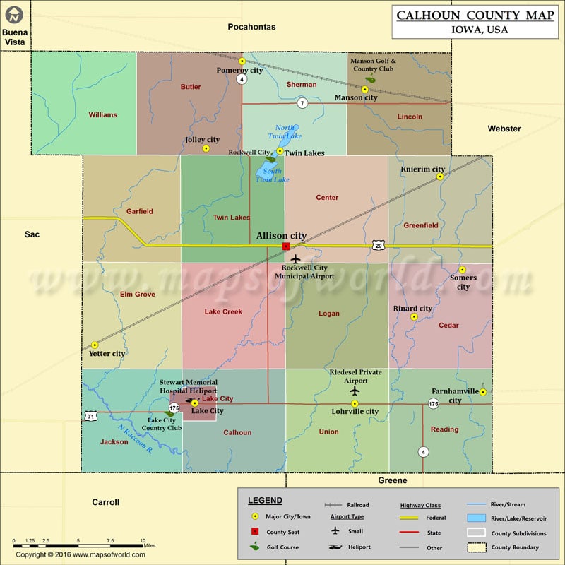
Airports in Calhoun County Airport Name Riedesel Private Airport Rockwell City Municipal Airport Stewart Memorial Hospital Heliport More Maps of Calhoun County Calhoun County Map, South Carolina Calhoun County Map,…
Airports in Calhoun County
Airport Name
Riedesel Private Airport
Rockwell City Municipal Airport
Stewart Memorial Hospital Heliport
More Maps of Calhoun County
Cities in Calhoun County
City
Population
Latitude
Longitude
Farnhamville city
371
42.276784
-94.407793
Jolley city
41
42.479448
-94.71826
Knierim city
60
42.45614
-94.455937
Lake City city
1727
42.267637
-94.731046
Lohrville city
368
42.267173
-94.551598
Manson city
1690
42.528385
-94.540154
Pomeroy city
662
42.55195
-94.67782
Rinard city
52
42.339613
-94.48493
Rockwell City city
1709
42.398164
-94.62888
Somers city
113
42.378713
-94.430956
Twin Lakes
334
42.477408
-94.635439
Yetter city
34
42.31613
-94.843166
Golf Courses in Calhoun County
Name of Golf Course
Latitude
Longitude
Lake City Country Club-Lake City
42.26044
-94.759784
Manson Golf & Country Club-Manson
42.53796
-94.534009
Twin Lakes Golf Course-Rockwell City
42.472095
-94.64594

 Wall Maps