- South Dakota Counties - South Dakota County Map, Map of South Dakota Counties
- Major Cities of South Dakota - Pierre
- Neighbouring States - North Dakota, Iowa, Minnesota, Nebraska, Wyoming , Montana
- Regional Maps - Map of USA
- Other South Dakota Maps - South Dakota Map, South Dakota Physical Map, South Dakota Airports Map, South Dakota Lati Long Map, South Dakota Zip Code Map, South Dakota Area Code Map, South Dakota National Parks Map
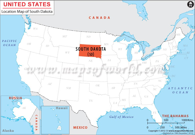
The exact geographical position of the state is clearly indicated in the South Dakota Location Map. Located in the western front of the north-central part of the United States of America, South Dakota encompasses total area of 199,730 square kilometer.
The state covers total land area of 196,715 square kilometer and total inland water area of 3,015 square kilometer. South Dakota shares its northern border with North Dakota, eastern border with Iowa and Minnesota, southern border with Nebraska and western border with Montana and Wyoming. The total length of the boundary of South Dakota is 2,118 kilometer.
South Dakota is stretched at a length of 610 kilometer in its east-west direction and 394 kilometer in its north-south direction and the coordinates of the state are 44.5° N, 100.0° W.
 Wall Maps