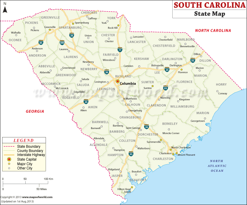
State map of South Carolina points out the cities like Chester, Augusta, Florence, Conway, Liberty, Anderson and many others are also prominently marked in the map. The 46 counties are vividly pointed out in the Map. The interstate highways that connect the cities and towns of the state are marked in the South Carolina map. Being located on the south-east of United States, South Carolina covers a total area of 80, 583 sq km.
South Carolina state map is also an important tool which offers information about the place. The cities like Chester, Augusta, Florence, Conway, Liberty, Anderson and many others are prominently marked in the map of South Carolina. The 46 counties along with the respective county seats are also vividly pointed out in the South Carolina Map. The interstate highways and rail routes that connect the cities and towns of the state are marked in the South Carolina map. Being located on the south-east of United States, South Carolina covers a total area of 80, 583 sq km. Apart from highlighting the roads, railways and cities the map of South Carolina also marks the important historical places of interest for the convenience of the tourists who visit the state from all over the world. People coming to this state of US can get a comprehensive overview from the South Carolina map. As a whole, the South Carolina map offers all necessary information which is quite relevant in context of the state.
 Wall Maps