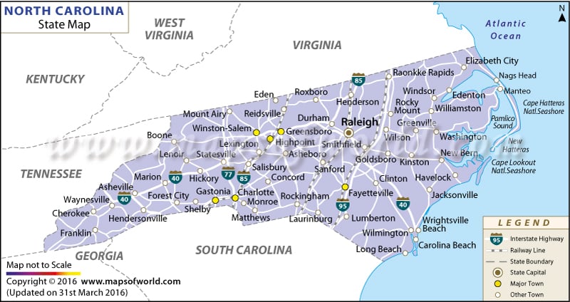
North Carolina covers a total area of 52,669 square miles on the southeastern corner of the United States.
Important towns, railway tracks, national highways, state highways and state capital are prominently marked in the North Carolina Map. Connected by an array of interstate and US highways, all the counties and towns of the state are easily accessible.
The towns, intersected by an extensive network of railways, the capital of Raleigh are indicated in the map. Other towns such as Fayetteville, Charlotte, Ruthfordton, Oxford, Franklin, Greensboro, Williamston, Bolton, Waynesville, Clinton, Marion, Salisbury and several others are clearly highlighted as well.
 Wall Maps