- Minnesota Counties - Minnesota County Map, Map of Minnesota Counties
- Major Cities of Minnesota - Rochester, Saint Paul, Duluth , Greater Minneapolis, Downtown Minneapolis
- Neighbouring States - North Dakota, Wisconsin, South Dakota, Iowa
- Regional Maps - Map of USA
- Other Minnesota Maps - Minnesota Map, Where is Minnesota, Minnesota Airports Map, Minnesota Lat Long Map, Minnesota Zip Code Map, Minnesota Area Code Map, Minnesota National Parks Map
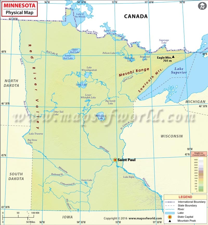
Physical Map of Minnesota
Minnesota is located in the Upper Midwest and the Great Lakes regions of the United States. Covering about 87,014 square miles, it is the 12th largest state in the US.
With an exception of few dramatic landscapes, much of the state is a gently rolling peneplain. The Northwest Angle in Minnesota is the only place north of the 49th parallel in the contiguous United States. Eagle Mountain, at 2,301 feet (701 meter) is the highest point in the state and it is only 13 miles from the 183-m elevation of Lake Superior. Two continental divides converge in northeastern Minnesota, which is characterized as the Arrowhead region. It includes the North Shore and the Boundary Waters. The North Woods is a heavily forested region that spans most of the state.
The state’s nickname – The Land of 10,000 Lakes – is not an exaggeration as there are more than 11,500 named lakes over 10 acres in size. Also, the state is dotted with roughly 10.6 million acres of wetlands. There are 6,564 natural rivers and streams in Minnesota. The headwaters of Mississippi River are located in Itasca State Park. The river flows about 680 miles in the state before crossing into Iowa. The Mississippi River marks the state’s southeastern border. The Red River Valley extends across the northwestern Minnesota. The river drains toward Hudson Bay in northwestern portion of the state.
Southwestern Minnesota features the Buffalo Ridge region with an elevation of more than 600 meters. Due to its high altitude, it produces large amount of alternative energy.
 Wall Maps