- Iowa Counties - Iowa County Map, Map of Iowa Counties
- Major Cities of Iowa - Des Moines, Waterloo
- Neighbouring States - Minnesota, Wisconsin, Illinois, Missouri, Nebraska, South Dakota
- Regional Maps - Map of USA
- Other Iowa Maps - Iowa Map, Where is Iowa, Iowa Airport Map, Iowa Lat Long Map, Iowa Zip Code Map, Iowa Area Code Map
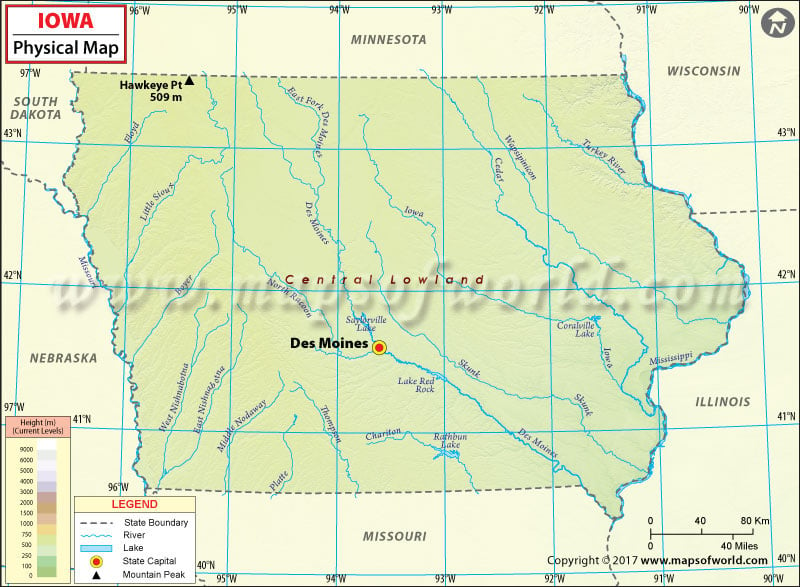
Iowa Physical Map
Iowa is bounded by the Mississippi River on the east and the Missouri River and the Big Sioux River on the west.
Known for its agriculture-based culture, the state is generally not flat; some of its area consists of rolling hills. Loess hills lie along the western border of the state. These are a formation of wind-deposited soil in western Iowa along the Missouri River. These hills or bluffs have oak-hickory hardwood forests in abundance and some of the last remaining prairie grass regions in Iowa.
The Iowa Great Lakes, in northwest part of the state, includes three principal lakes: Spirit Lake, West Okoboji Lake, and East Okoboji Lake. The Coteau des Prairies in northwestern Iowa rises from the prairie flatlands. North-central Iowa features an expanse of fertile land dotted with a scattering of gently rolling hills. Northeast Iowa, along the Mississippi River, lies under the Driftless Zone that features steep hills and valleys which appear mountainous.
Dissected Till Plains, which are a part of the Interior Plains, are located in southern and western Iowa region. These plains are also the western edge of the Corn Belt. Spanning northeastern Iowa, the Driftless Area or Paleozoic Plateau region is noted mainly for its deeply carved river valleys. The Southern Drift Plains in southern Iowa cover about one-third of total area of Iowa.
 Wall Maps