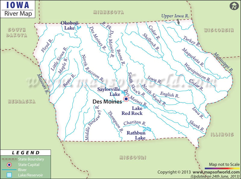
The Mississippi river and the Missouri river are the two main rivers of Iowa state. While almost two thirds of the eastern region of the state falls under the watershed of the Mississippi river, the western zone of Iowa comes under the watershed of the Missouri river.
Among the 19,000 miles of nat-ural streams and rivers, some are prominently marked in the Iowa River Map. The River Map of Iowa also highlights the various towns that are located on the banks of the major rivers of the state. Towns like Davenport, Dubuque, Sioux City, Cedar Rapids, Dewitt, Clinton, Fort Dodge, and Des Moines, among others, are clearly marked in the Iowa River Map.
The River Map – of Iowa also highlights those states which surround Iowa such as Wisconsin, Nebraska, Illinois, South Dakota, Missouri, and Minnesota.
The rivers of Iowa flow throughout the entire state, playing a significant role in the improvement of agriculture. The Iowa river, Cedar river, and Des Moines river are just a few important waterways of Iowa state. Lakes and ponds are also a part of the watercourses of Iowa, West Okoboji Lake and Spirit Lake are the two largest lakes within Iowa.
 Wall Maps