1.2K
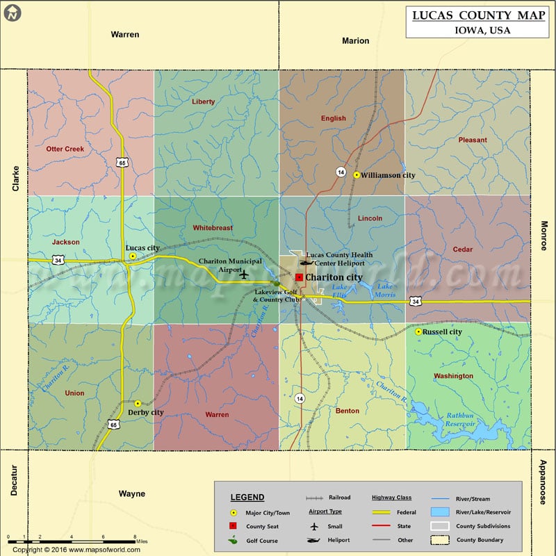
Airports in Lucas County
| Airport Name |
|---|
| Chariton Municipal Airport |
| Lucas County Health Center Heliport |
Cities in Lucas County
| City | Population | Latitude | Longitude |
|---|---|---|---|
| Chariton city | 4321 | 41.017575 | -93.309449 |
| Derby city | 115 | 40.930336 | -93.456483 |
| Lucas city | 216 | 41.032211 | -93.461049 |
| Russell city | 554 | 40.980105 | -93.200539 |
| Williamson city | 152 | 41.088242 | -93.256882 |
Golf Courses in Lucas County
| Name of Golf Course | Latitude | Longitude |
|---|---|---|
| Lakeview Golf & Country Club-Chariton | 41.0149 | -93.331294 |
 Wall Maps