796
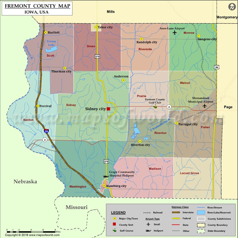
Airports in Fremont County
| Airport Name |
|---|
| Aero-Lane Airport |
| Grape Community Hospital Heliport |
| Shenandoah Municipal Airport |
Cities in Fremont County
| City | Population | Latitude | Longitude |
|---|---|---|---|
| Anderson | 65 | 40.798309 | -95.60849 |
| Bartlett | 50 | 40.885339 | -95.794666 |
| Farragut city | 485 | 40.720007 | -95.480685 |
| Hamburg city | 1187 | 40.606121 | -95.654576 |
| Imogene city | 72 | 40.879039 | -95.427529 |
| Percival | 87 | 40.751269 | -95.813266 |
| Randolph city | 168 | 40.873434 | -95.564725 |
| Riverton city | 304 | 40.686818 | -95.568613 |
| Sidney city | 1138 | 40.745949 | -95.644299 |
| Tabor city | 1040 | 40.894939 | -95.673712 |
| Thurman city | 229 | 40.820224 | -95.74881 |
Golf Courses in Fremont County
| Name of Golf Course | Latitude | Longitude |
|---|---|---|
| Fremont County Golf Club-Sidney | 40.75068 | -95.532819 |
