1.9K
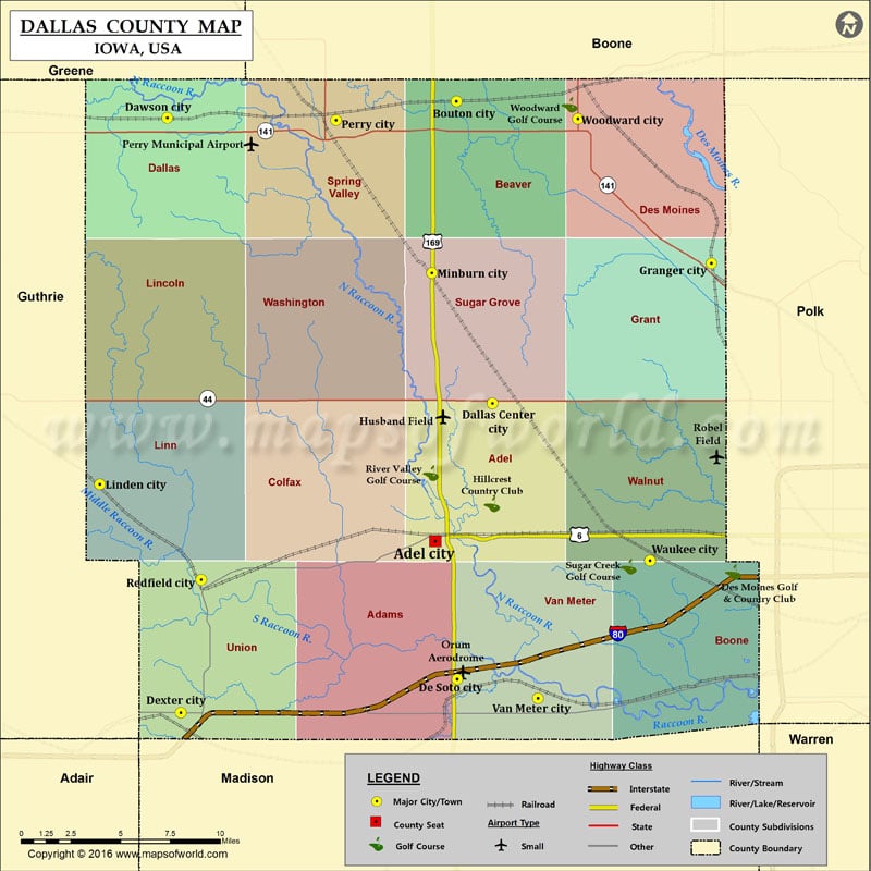
Airports in Dallas County
| Airport Name |
|---|
| Husband Field |
| Orum Aerodrome |
| Perry Municipal Airport |
| Robel Field |
Cities in Dallas County
| City | Population | Latitude | Longitude |
|---|---|---|---|
| Adel city | 3682 | 41.61155 | -94.025928 |
| Bouton city | 129 | 41.851315 | -94.010415 |
| Dallas Center city | 1623 | 41.686785 | -93.984292 |
| Dawson city | 131 | 41.842381 | -94.220875 |
| De Soto city | 1050 | 41.536179 | -94.009863 |
| Dexter city | 611 | 41.517905 | -94.21101 |
| Granger city | 1244 | 41.763061 | -93.825001 |
| Linden city | 199 | 41.642642 | -94.269885 |
| Minburn city | 365 | 41.757842 | -94.028361 |
| Perry city | 7702 | 41.841096 | -94.09804 |
| Redfield city | 835 | 41.590604 | -94.196112 |
| Van Meter city | 1016 | 41.525788 | -93.951288 |
| Waukee city | 13790 | 41.601001 | -93.869616 |
| Woodward city | 1024 | 41.841705 | -93.92218 |
Golf Courses in Dallas County
| Name of Golf Course | Latitude | Longitude |
|---|---|---|
| Des Moines Golf & Country Club-West Des Moines | 41.59472 | -93.809226 |
| Hillcrest Country Club-Adel | 41.631745 | -93.984585 |
| River Valley Golf Course-Adel | 41.648701 | -94.029128 |
| Sugar Creek Golf Course-Waukee | 41.597686 | -93.885304 |
| Woodward Golf Course-Woodward | 41.849452 | -93.928277 |
 Wall Maps