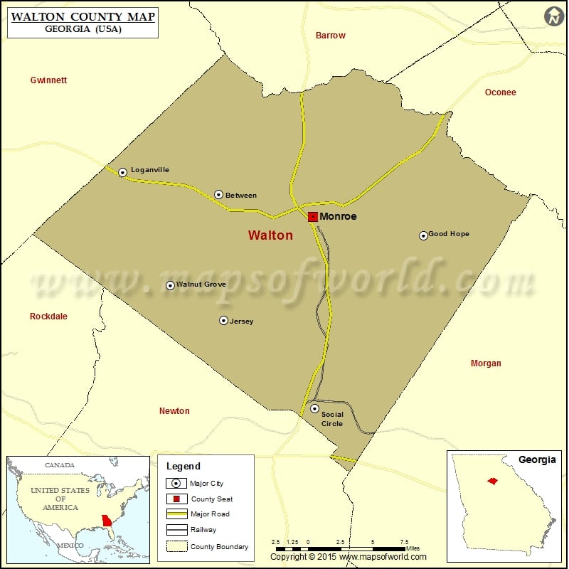
Check this Georgia County Map to locate all the state’s counties in Georgia Map.
Mountain Peaks in Walton County
| Mountain Peak/Hill | Elevation [Meter] |
|---|---|
| Alcovy Mountain | 319 |
| Jacks Creek Mountain | 299 |
| Turkey Creek Mountain | 272 |
More Maps of Walton County
Airports in Walton County
| Airport Name |
|---|
| Aerie Airport |
| Alcovy Airport |
| Apalachee Bluff Airpark |
| Becker Heliport |
| Flying G Ranch Airport |
| Kintail Farm Airport |
| Monroe Walton County Airport |
| Spring Valley Farm Airport |
| Sunset Strip |
| Walton County Hospital Heliport |
Cities in Walton County
| City | Population | Latitude | Longitude |
|---|---|---|---|
| Between town | 296 | 33.81777 | -83.804335 |
| Good Hope city | 274 | 33.78499 | -83.60938 |
| Jersey City | 137 | 33.717686 | -83.800038 |
| Loganville city | 10458 | 33.835282 | -83.895753 |
| Monroe city | 13234 | 33.799688 | -83.715419 |
| Social Circle city | 4262 | 33.647596 | -83.712899 |
| Walnut Grove city | 1330 | 33.745399 | -83.850269 |
Golf Courses in Walton County
| Name of Golf Course | Latitude | Longitude |
|---|---|---|
| Bear Creek Golf Club-Monroe | 33.781258 | -83.787668 |
| Cedar Lake Golf Club-Loganville | 33.771235 | -83.923641 |
| Monroe Golf & Country Club-Monroe | 33.767616 | -83.724114 |
| The Providence Club-Monroe | 33.900798 | -83.770698 |
 Wall Maps