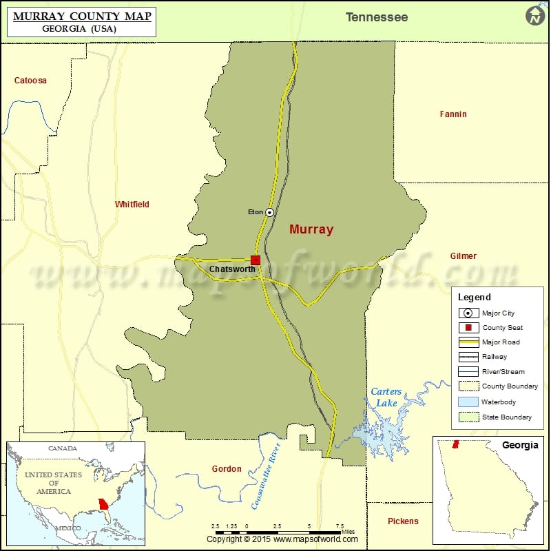
Check this Georgia County Map to locate all the state’s counties in Georgia Map.
Mountain Peaks in Murray County
| Mountain Peak/Hill | Elevation [Meter] |
|---|---|
| Bald Mountain | 1222 |
| Beaver Mountain | 492 |
| Buck Knob | 510 |
| Camp Ground Mountain | 338 |
| Chestnut Knob | 677 |
| Cohutta Mountain | 1222 |
| Cold Spring Mountain | 808 |
| Doogan Mountain | 584 |
| Fancy Hill | 259 |
| Fort Mountain | 868 |
| Grassy Mountain | 1125 |
| High Top | 338 |
| Iron Mountain | 511 |
| Iron Mountain | 511 |
| Little Bald Mountain | 1126 |
| Peaky Top | 533 |
| Potatopatch Mountain | 1085 |
| Ridley Hill | 242 |
| Rocky Face | 903 |
Airports in Murray County
| Airport Name |
|---|
| Blue Bird Field |
| Petty Farms Airport |
| R.M. Harris Airport |
| Rostex Airport |
Cities in Murray County
| City | Population | Latitude | Longitude |
|---|---|---|---|
| Chatsworth city | 4299 | 34.780708 | -84.783392 |
| Eton city | 910 | 34.826598 | -84.76678 |
Golf Courses in Murray County
| Name of Golf Course | Latitude | Longitude |
|---|---|---|
| Indian Trace Golf Course-Chatsworth | 34.811431 | -84.828447 |
| Spring Lakes Golf Club-Chatsworth | 34.743831 | -84.804317 |
 Wall Maps