4.2K
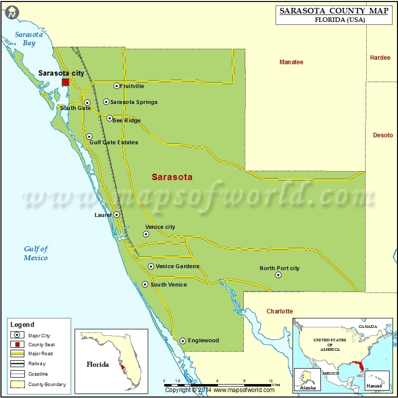
Check this Florida County Map to locate all the state’s counties in Florida Map.
Mountain Peaks in Sarasota County
| Mountain Peak/Hill | Elevation [Meter] |
|---|---|
| Caloosa Indian Mound | 7 |
Airports in Sarasota County
| Airport Name |
|---|
| Buchan Airport |
| Dove Heliport |
| Hidden River Airport |
| Lowe’s Airport |
| Mosquito Ctl Heliport |
| North Port Ems Heliport |
| Oaks Helistop |
| Sarasota Dept Of Fire-Rescue East Side Heliport |
| Sarasota Memorial Hospital Heliport |
| Schwartz Farms Inc Airport |
| Venice Municipal Airport |
Cities in Sarasota County
| City | Population | Latitude | Longitude |
|---|---|---|---|
| Bee Ridge | 9598 | 27.285503 | -82.473099 |
| Desoto Lakes | 3646 | 27.37304 | -82.496799 |
| Englewood | 14863 | 26.96037 | -82.353511 |
| Fruitville | 13224 | 27.332795 | -82.461526 |
| Gulf Gate Estates | 10911 | 27.258751 | -82.506563 |
| Kensington Park | 3901 | 27.359016 | -82.49326 |
| Lake Sarasota | 4679 | 27.291562 | -82.437027 |
| Laurel | 8171 | 27.144643 | -82.461803 |
| Nokomis | 3167 | 27.122745 | -82.436917 |
| North Port city | 57357 | 27.057454 | -82.197686 |
| North Sarasota | 6982 | 27.370921 | -82.517711 |
| Osprey | 6100 | 27.191368 | -82.479949 |
| Plantation | 4919 | 27.064843 | -82.368945 |
| Ridge Wood Heights | 4795 | 27.287404 | -82.513638 |
| Sarasota city | 51917 | 27.338068 | -82.545137 |
| Sarasota Springs | 14395 | 27.309252 | -82.478853 |
| Siesta Key | 6565 | 27.277842 | -82.551586 |
| South Gate Ridge | 5688 | 27.285622 | -82.496987 |
| South Sarasota | 4950 | 27.285663 | -82.533214 |
| South Venice | 13949 | 27.043558 | -82.41524 |
| Southgate | 7173 | 27.308362 | -82.509639 |
| The Meadows | 3994 | 27.365334 | -82.472389 |
| Vamo | 4727 | 27.225325 | -82.494494 |
| Venice city | 20748 | 27.116296 | -82.413559 |
| Venice Gardens | 7104 | 27.069213 | -82.405734 |
| Warm Mineral Springs | 5061 | 27.046915 | -82.270178 |
 Wall Maps