2.4K
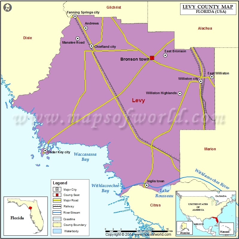
Check this Florida County Map to locate all the state’s counties in Florida Map.
Mountain Peaks in Levy County
| Mountain Peak/Hill | Elevation [Meter] |
|---|---|
| Hodgson Hill | 11 |
| Shell Mound | 4 |
| Spring Hill | 41 |
Airports in Levy County
| Airport Name |
|---|
| Ames Field |
| Brookins Air Strip |
| Chiefland Sky Ranch Airport |
| George T Lewis Airport |
| Neal Field |
| Randolph Air Force Base Auxiliary Airport |
| Redtail Airstrip |
| The Cedars Airfield |
| White Farms Airport |
| Williston Memorial Hospital Heliport |
| Williston Municipal Airport |
| Wings Field |
Cities in Levy County
| City | Population | Latitude | Longitude |
|---|---|---|---|
| Andrews | 798 | 29.548176 | -82.887998 |
| Bronson town | 1113 | 29.449901 | -82.639208 |
| Cedar Key city | 702 | 29.145247 | -83.038469 |
| Chiefland city | 2245 | 29.489522 | -82.866488 |
| East Bronson | 1945 | 29.459297 | -82.590537 |
| East Williston | 694 | 29.388354 | -82.416478 |
| Fanning Springs city | 764 | 29.586979 | -82.928468 |
| Inglis town | 1325 | 29.032706 | -82.659193 |
| Manatee Road | 2244 | 29.514458 | -82.918198 |
| Morriston | 164 | 29.281127 | -82.440031 |
| Otter Creek town | 134 | 29.323999 | -82.77366 |
| Raleigh | 373 | 29.447868 | -82.468078 |
| Williston city | 2768 | 29.373621 | -82.457574 |
| Williston Highlands | 2275 | 29.333616 | -82.535656 |
| Yankeetown town | 502 | 29.028828 | -82.761371 |
Golf Courses in Levy County
| Name of Golf Course | Latitude | Longitude |
|---|---|---|
| Chiefland Golf & Country Club-Chiefland | 29.496195 | -82.93465 |
| Williston Highlands Golf & Country Club-Williston | 29.342733 | -82.511457 |
 Wall Maps