2.7K
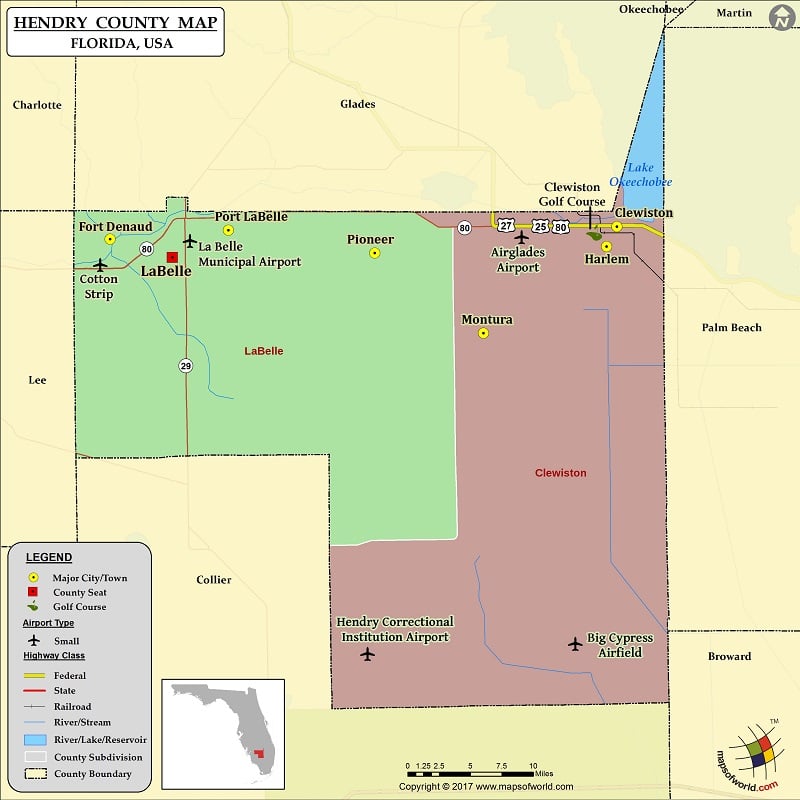
Check this Florida County Map to locate all the state’s counties in Florida Map.
Mountain Peaks in Hendry County
| Mountain Peak/Hill | Elevation [Meter] |
|---|---|
| Maple Mound | 6 |
| Tonys Mound | 5 |
Airports in Hendry County
| Airport Name |
|---|
| Airglades Airport |
| Berry Grove Airport |
| Big Cypress Airfield |
| Bob Paul Airport |
| Charlton Strip |
| Colony Heliport |
| Cotton Strip |
| Duda Airstrip |
| Harper’s Fly-In Ranch Airport |
| Hendry Correctional Institution Airport |
| Hendry County Fire-Ems Heliport |
| La Belle Municipal Airport |
| Mc Daniel Ranch Inc. Airport |
| South Point Airport |
| Southern Ranch Airport |
| Strayhorn Ranch Airport |
| William’s Sky Manor Airport |
Cities in Hendry County
| City | Population | Latitude | Longitude |
|---|---|---|---|
| Clewiston city | 7155 | 26.7532 | -80.939907 |
| Fort Denaud | 1694 | 26.740247 | -81.524146 |
| Harlem | 2658 | 26.732435 | -80.951848 |
| LaBelle city | 4640 | 26.721227 | -81.452532 |
| Montura | 3283 | 26.64283 | -81.093739 |
| Pioneer | 697 | 26.725842 | -81.21896 |
| Port LaBelle | 3530 | 26.749339 | -81.387713 |
Golf Courses in Hendry County
| Name of Golf Course | Latitude | Longitude |
|---|---|---|
| Clewiston Golf Course-Clewiston | 26.74684 | -80.951079 |
 Wall Maps