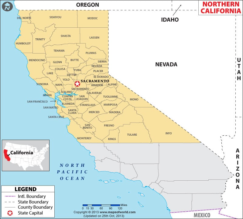
Northern California region comprises the northernmost 48 counties of the ‘Golden State’. From the towering redwoods along the Pacific Coast to the mighty Sierra Nevada Mountains in the east, the region is famous for vineyards, recreational dwellings, Victorian towns, glorious coastline, and the Golden Gate Bridge.
The southern borders of Monterey, Kings, Tulare and Inyo counties define the boundaries which separate Northern California from Southern California. The first European settlement in the area was at the Spanish mission at Monterey in 1770. From the California Gold Rush in the Central Valley to the dot-com boom in the Silicon Valley, the region has played a pivotal role in the modern history of America.
The world-renowned educational institutions, Stanford University and University of California, Berkeley are in the region. Sacramento is the state capital and San Jose is the largest city in Northern California.
Tourist Attractions in Northern California
Whether it is beaches, mountains, or forests, one of the many joys of living in NorCal is that idyllic getaways are never far away. Yosemite National Park and Redwood National and State Parks are two UNESCO World Heritage Sites. The Golden Gate National Recreation Area and Death Valley National Park are popular travel destinations.
Wine tasting in wineries of Napa Valley, whale watching in Bodega Bay, surfing near Bolinas or Shelter Cove, and driving through Big Sur are popular things to do in Northern California.
Major Cities in Northern California
The region has two population centers: San Francisco Bay Area and Greater Sacramento Area. Here’s a list of major cities –
- San Francisco
- San Jose
- Sacramento
- Oakland
- Fresno
- Stockton
- Modesto
- Fremont
- Santa Rosa
- San Rafael
- Redding
- Salinas
- Visalia
- Chico
- Eureka
Getting In and Around
San Francisco International Airport (SFO) is the busiest airport in Northern California.
Amtrak operates California Zephyr, Capitol Corridor, Coast Starlight, and San Joaquin through the region. Commuter trains and light rails serve the metropolitan areas of San Francisco and Sacramento.
I-80, I-5, and U.S. Route 6 traverse the region.
 Wall Maps