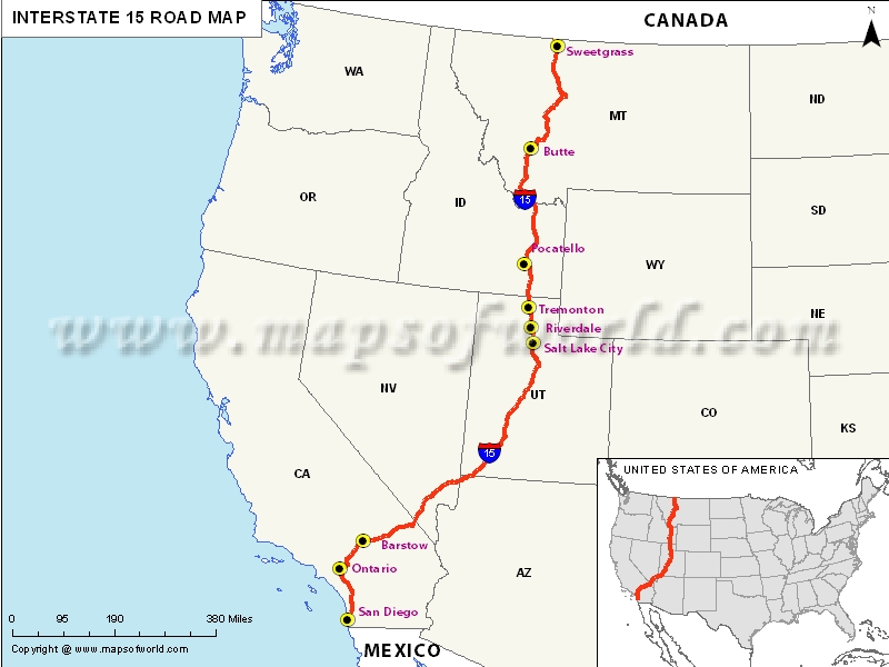
US Interstate 15 highway Map
Interstate 15, popularly abbreviated as I-15, is the major interstate highway in the western United States. It begins near the Mexico-US border in San Diego County and stretched towards north to Alberta, Canada.
I-15 passes through the urban areas of Orange County, Los Angeles County, California, Utah, Ogden and Helena, Montana. It’s stretches in Utah, Idaho and Arizona have been uniquely designed as the “Veterans Memorial Highway”.
Extent of I-15 Highway
Interstate 15’s northern terminus is in Sweet Grass, Montana, at the Canada-US border, where it transforms into Alberta Highway 4. On the contrary, I-15’s southern terminus is in San Diego, California, at Interstate 8.
I-15 is 1,433 miles long, stretching from San Diego to Sweet Grass. It begins in Primm and continues across Las Vegas along the Las Vegas Strip corridor. Further, it crosses the border with Arizona in Mesquite. I-15 in Nevada runs in Clark County, for a distance of 123.8 miles.
States and cities along I-15 Highway
- Nevada
- Arizona
- Utah: Ogden-Layton, Provo-Orem, Salt Lake City, St. George
- Idaho: Idaho Falls, Pocatello
- Montana
- California: San Diego, San Bernardino, Temecula-Murrieta
Restaurants along Interstate-15 Highway
Here is a list of few great restaurants along Interstate-15 Highway:
- Timberline Inn Restaurant
- Pho Hoa Restaurant
- 94th Aero Squadron
- Saigon Restaurant
- Chef’s Wok
Attractions along I-15 Highway
Some of the renowned tourist attractions along I-15 Highway include:
- Valley of Fire State Park
- Mojave National Preserve
- Barstow
- Palomar Mountain
- Helena National Forest
Route of Interstate Highway No.15 |
|---|
| State | Entry Point | Exit Point | Length |
|---|
| California | San Diego, CA | Cima, CA | 293.64 mi (472.57 km) |
| Nevada | Primm, NV | Mesquite, NV | 123.776 mi (199.198 km) |
| Arizona | Littlefield, AZ | Black Rock, AZ | 29.43 mi (47.36 km) |
| Utah | St. George, UT | Tremonton, UT | 400.592 mi (644.690 km) |
| Idaho | Oneida, ID | Clark, ID | 196.000 mi (315.431 km) |
| Montana | Lima, MT | Sunburst, MT | 397.50 mi (639.71 km) |
| Total Length | | | 1,433.52 mi (2,307.03 km) |
Last Updated on: April 15, 2017


