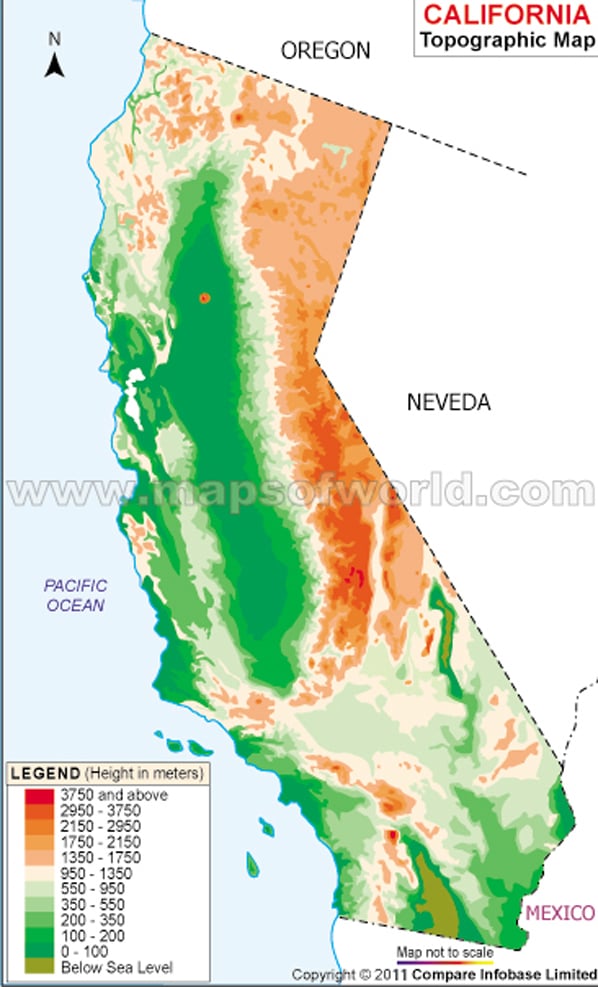
Topographic Map of California shows the state’s terrain, or land surface features. It is created by using contour lines to represent changes in elevation and to depict the shape and slope of the land. On a topographic map of California, the contour lines are typically color-coded to represent different elevations, with darker lines indicating lower elevations and lighter lines indicating higher elevations. The map may also include other information, such as the location of roads, bodies of water, and vegetation, which can be used to better understand the landscape and geography of the state. Topographic maps are used by a variety of people, including hikers, hunters, geologists, and engineers, to help them navigate and understand the land.
California Topographic Map
Below is the topographic map of California showing topographies on original scale.
