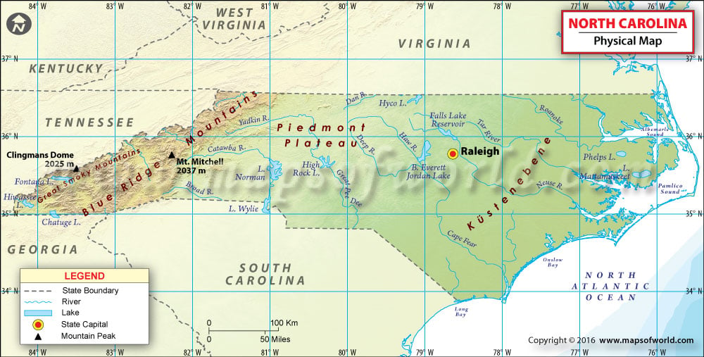
North Carolina Physical Map
The state of North Carolina is categorized into three divisions: the Appalachian Mountains in the west, the Middle or Piedmont Plateau, and the Eastern or Tidewater region known as the Coastal Plain.
The Appalachian Mountains and its sub-ranges form the Mountain Region that stretches in Western North Carolina. Located east of the Tennessee border and west of the Piedmont, the region features the tallest mountains in the Eastern United States. The region comprises four chains of the Appalachians. The Great Smoky Mountains are also known as the Smokies. The Blue Ridge Mountains are the state’s largest mountain range. Mount Mitchell in the Black Mountains at 2,037.3 meters is the highest peak east of the Mississippi River. The western slopes of the Blue Ridge are the headwaters of the French Broad and the Kanawha Rivers, whereas eastern slopes give rise to the Catawba River and the Yadkin River. The Brushy Mountains separate the waters of the Catawba River and Yadkin River. The Uwharrie Mountains are the easternmost mountain range in North Carolina and also one of the oldest mountain ranges in North America.
The Piedmont plateau extends in the central North Carolina. The region borders the Coastal Plain at the Fall Line. This hilly region varies in mean elevation from 300 feet to 1,100 feet. The Foothills in the eastern Piedmont feature a transitional terrain that lowers from the Appalachian Mountains.
Located east of the Piedmont and west of the Atlantic Ocean, the Coastal Plain is the largest physical region in the state, comprising roughly 45% of North Carolina. The coastal plain includes the two largest landlocked sounds in the US: Albemarle Sound in the north and Pamlico Sound in the south. The southeastern-most portion of the state includes the Outer Banks, which is a string of peninsulas and barrier islands with no coral reef.

 Wall Maps