
Iowa has a mean elevation of 336 meter. Situated at a height of 1,670 feet, Hawkeye Point is the highest point of the State of Iowa. River Mississippi is the lowest point of Iowa which is placed at 480 feet above sea level. The State of Iowa is drained by several rivers that have made the state very fertile and grows variety of agricultural crops. Some of the prominent rivers flowing through the state are Missouri River, Mississippi River, Iowa River, Des Moines River and Cedar River. River Mississippi and its tributaries flow across the eastern part of Iowa. Missouri River flows through the western region of the state. Red Rock Lake, Rathbun Lake, Saylorville Lake and Wokoboji Lake are few of the notable natural lakes of Iowa. The glacial plain of the state comprises five glaciers that led to the formation of small lakes in the northern part of Iowa. The Iowa Map offers detailed information on the heterogeneous topography of the state.
Iowa Topographic Map
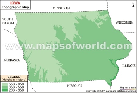
The relief features of the state are clearly marked in the Iowa topographic map. The topography of Iowa is characterized by undulating plains that stretches from the northwestern part of the state to the southeastern region of Iowa.
Map of Iowa showing topographies on original scale.