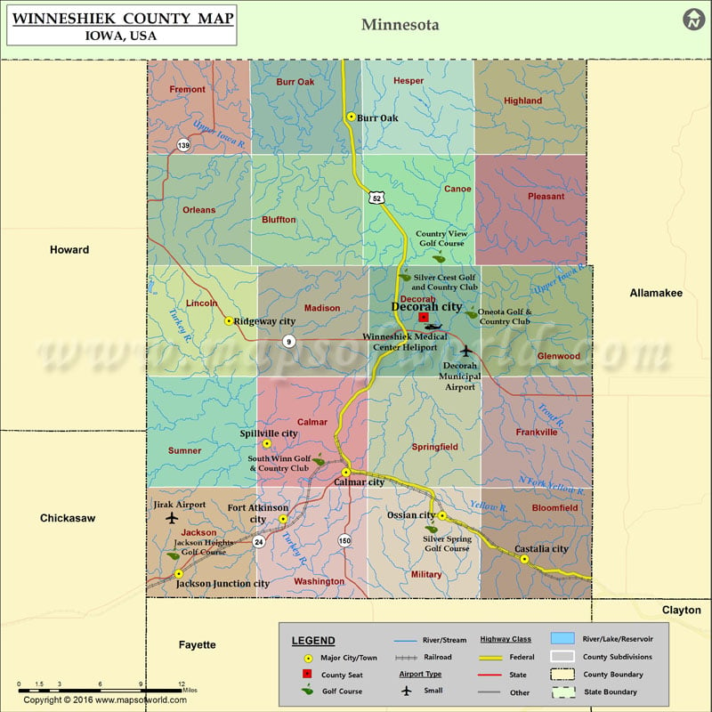
Winneshiek County Map, Iowa
Airports in Winneshiek County Airport Name Decorah Municipal Airport Jirak Airport Winneshiek Medical Center Heliport Cities in Winneshiek County City Population Latitude Longitude Burr Oak 166 43.457984 -91.861927 Calmar city…
Airports in Winneshiek County
Airport Name
Decorah Municipal Airport
Jirak Airport
Winneshiek Medical Center Heliport
Cities in Winneshiek County
City
Population
Latitude
Longitude
Burr Oak
166
43.457984
-91.861927
Calmar city
978
43.180564
-91.867751
Castalia city
173
43.112805
-91.676962
Decorah city
8127
43.301808
-91.784999
Fort Atkinson city
349
43.144115
-91.934775
Jackson Junction city
58
43.101324
-92.046216
Ossian city
845
43.146728
-91.764855
Ridgeway city
315
43.298877
-91.992637
Spillville city
367
43.203127
-91.952078
Golf Courses in Winneshiek County
Name of Golf Course
Latitude
Longitude
Country View Golf Course-Decorah
43.349162
-91.768549
Jackson Heights Golf Course-Jackson Junction
43.117095
-92.052249
Oneota Golf & Country Club-Decorah
43.305592
-91.733984
Silver Crest Golf and Country Club-Decorah
43.334803
-91.805046
Silver Spring Golf Course-Ossian
43.138074
-91.776404
South Winn Golf & Country Club-Calmar
43.190952
-91.89713

 Wall Maps