Winnebago County Map, Iowa
Airports in Winnebago County Airport Name Friesenborg & Larson Airport Lake Mills Municipal Airport Rake Airport More Maps of Winnebago County Winnebago County Map, Wisconsin Cities in Winnebago County City…
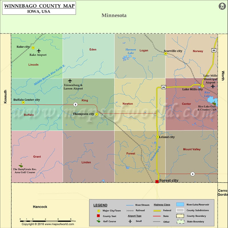
Airports in Winnebago County
Airport Name
Friesenborg & Larson Airport
Lake Mills Municipal Airport
Rake Airport
More Maps of Winnebago County
Cities in Winnebago County
City
Population
Latitude
Longitude
Buffalo Center city
905
43.389389
-93.942811
Lake Mills city
2100
43.416949
-93.532064
Leland city
289
43.331816
-93.635098
Rake city
225
43.480567
-93.920173
Scarville city
72
43.470967
-93.616572
Thompson city
502
43.36975
-93.774695
Golf Courses in Winnebago County
Name of Golf Course
Latitude
Longitude
Rice Lake Golf & Country Club-Lake Mills
43.388599
-93.50574
The Barn/Gruis Rec. Area Golf Course-Buffalo Center
43.284301
-93.948621

 Wall Maps