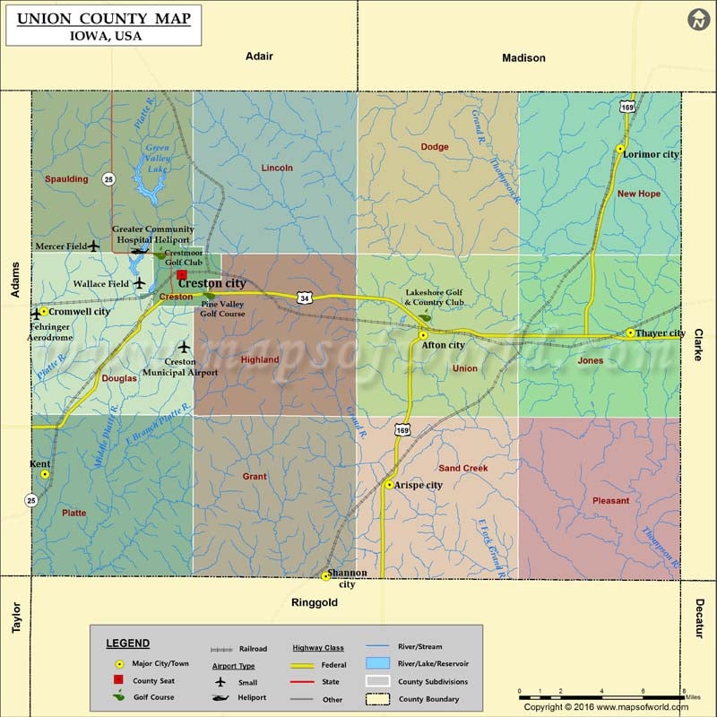
Airports in Union County Airport Name Creston Municipal Airport Fehringer Aerodrome Greater Community Hospital Heliport Mercer Field Wallace Field More Maps of Union County Union County Map, South Dakota Union…
Airports in Union County
Airport Name
Creston Municipal Airport
Fehringer Aerodrome
Greater Community Hospital Heliport
Mercer Field
Wallace Field
More Maps of Union County
Cities in Union County
City
Population
Latitude
Longitude
Afton city
845
41.027618
-94.195373
Arispe city
100
40.948031
-94.219151
Creston city
7834
41.05973
-94.365039
Cromwell city
107
41.040313
-94.461737
Kent
61
40.953632
-94.461127
Lorimor city
360
41.126676
-94.057049
Shannon City city
71
40.8992
-94.26386
Thayer city
59
41.028967
-94.049735
Golf Courses in Union County
Name of Golf Course
Latitude
Longitude
Crestmoor Golf Club-Creston
41.07115
-94.380689
Lakeshore Golf & Country Club-Afton
41.038164
-94.194387
Pine Valley Golf Course-Creston
41.050006
-94.345969

 Wall Maps