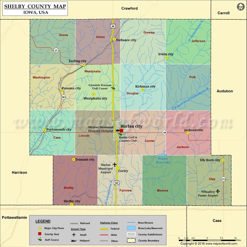
Airports in Shelby County Airport Name Harlan Municipal Airport Myrtue Memorial Hospital Heliport Wheatley Farms Airport More Maps of Shelby County Shelby County Map, Alabama Shelby County Map, Texas Shelby…
Airports in Shelby County
Airport Name
Harlan Municipal Airport
Myrtue Memorial Hospital Heliport
Wheatley Farms Airport
More Maps of Shelby County
Cities in Shelby County
City
Population
Latitude
Longitude
Corley
26
41.577719
-95.330558
Defiance city
284
41.825418
-95.340354
Earling city
437
41.776173
-95.418991
Elk Horn city
662
41.592984
-95.06156
Harlan city
5106
41.649515
-95.326862
Irwin city
341
41.790157
-95.206793
Jacksonville
30
41.645074
-95.151692
Kirkman city
64
41.728056
-95.267288
Panama city
221
41.726351
-95.475476
Portsmouth city
195
41.650416
-95.519314
Shelby city
641
41.507515
-95.450335
Tennant city
68
41.594116
-95.444935
Westphalia city
127
41.719252
-95.393665
Golf Courses in Shelby County
Name of Golf Course
Latitude
Longitude
Glendale Rosman Golf Course-Harlan
41.73255
-95.343799
Harlan Golf & Country Club-Harlan
41.644124
-95.325783

 Wall Maps