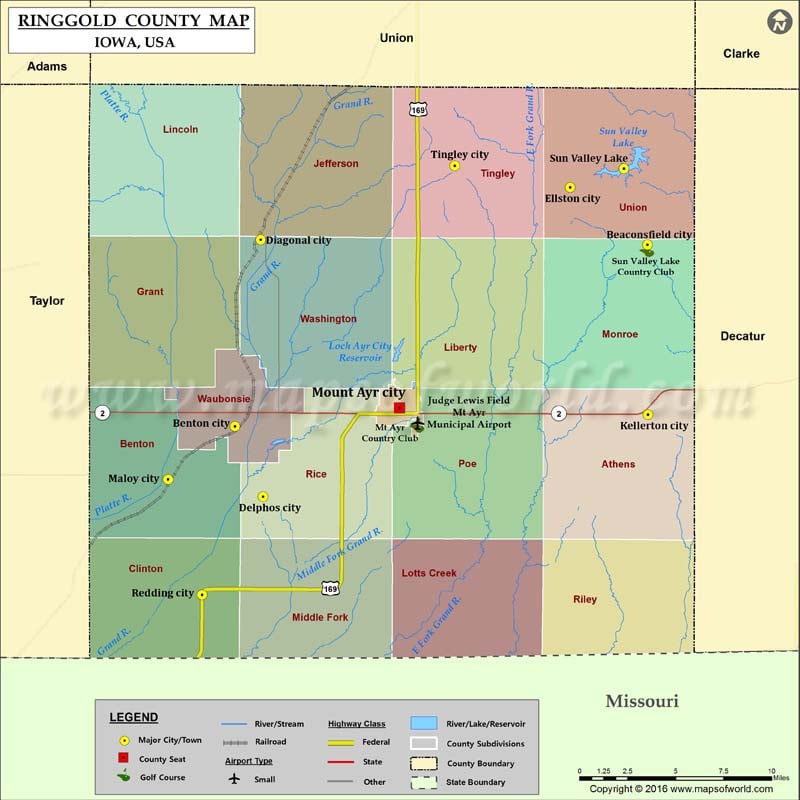
Ringgold County Map, Iowa
Airports in Ringgold County Airport Name Judge Lewis Field Mt Ayr Municipal Airport Cities in Ringgold County City Population Latitude Longitude Beaconsfield city 15 40.807575 -94.05068 Benton city 41…
Airports in Ringgold County
Airport Name
Judge Lewis Field Mt Ayr Municipal Airport
Cities in Ringgold County
City
Population
Latitude
Longitude
Beaconsfield city
15
40.807575
-94.05068
Benton city
41
40.703567
-94.36142
Delphos city
25
40.663174
-94.340275
Diagonal city
330
40.810467
-94.342112
Ellston city
43
40.840493
-94.108754
Kellerton city
315
40.710258
-94.050249
Maloy city
29
40.67318
-94.41192
Mount Ayr city
1691
40.714157
-94.237585
Redding city
82
40.60683
-94.386288
Sun Valley Lake
161
40.851162
-94.068356
Tingley city
184
40.852747
-94.195803
Golf Courses in Ringgold County
Name of Golf Course
Latitude
Longitude
Mt Ayr Country Club-Mount Ayr
40.704019
-94.224141
Sun Valley Lake Country Club-Ellston
40.804697
-94.050924

 Wall Maps