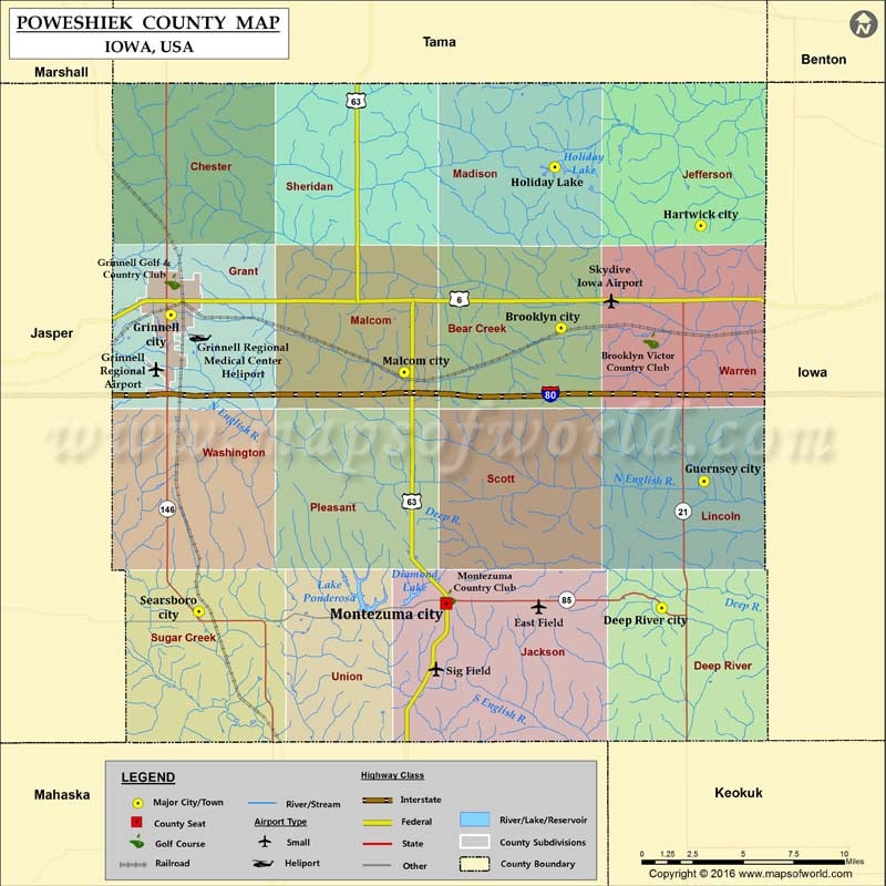
Poweshiek County Map, Iowa
Airports in Poweshiek County Airport Name East Field Grinnell Regional Airport Grinnell Regional Medical Center Heliport Sig Field Skydive Iowa Airport Cities in Poweshiek County City Population Latitude Longitude Brooklyn…
Airports in Poweshiek County
Airport Name
East Field
Grinnell Regional Airport
Grinnell Regional Medical Center Heliport
Sig Field
Skydive Iowa Airport
Cities in Poweshiek County
City
Population
Latitude
Longitude
Brooklyn city
1468
41.731347
-92.445328
Deep River city
279
41.581179
-92.373227
Grinnell city
9218
41.738269
-92.724335
Guernsey city
63
41.649151
-92.343087
Hartwick city
86
41.786146
-92.345356
Holiday Lake
433
41.817388
-92.449635
Malcom city
287
41.707596
-92.557463
Montezuma city
1462
41.583376
-92.527382
Searsboro city
148
41.579208
-92.704277
Golf Courses in Poweshiek County
Name of Golf Course
Latitude
Longitude
Brooklyn Victor Country Club-Brooklyn
41.724552
-92.380942
Grinnell Golf & Country Club-Grinnell
41.756132
-92.723418
Montezuma Country Club-Montezuma
41.586805
-92.526024

 Wall Maps