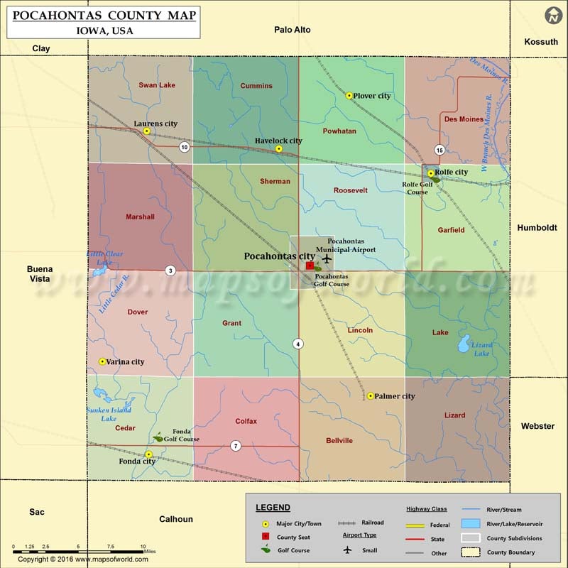
Iowa Counties Pocahontas County Map, Iowa Vishul MalikAugust 8, 202201.6K views Airports in Pocahontas County Airport Name Pocahontas Municipal Airport Cities in Pocahontas County City Population Latitude Longitude Fonda city 631 42.581696 -94.845942 Havelock city 138 42.833109 -94.700855 Laurens city 1258… Buy Printed MapBuy Digital MapWall MapsCustomize Airports in Pocahontas County Airport Name Pocahontas Municipal Airport Cities in Pocahontas County City Population Latitude Longitude Fonda city 631 42.581696 -94.845942 Havelock city 138 42.833109 -94.700855 Laurens city 1258 42.847747 -94.848295 Palmer city 165 42.629862 -94.598473 Plover city 77 42.876712 -94.622227 Pocahontas city 1789 42.737136 -94.66613 Rolfe city 584 42.812901 -94.53134 Varina city 71 42.658118 -94.897667 Golf Courses in Pocahontas County Name of Golf Course Latitude Longitude Fonda Golf Course-Fonda 42.59606 -94.835638 Pocahontas Golf Course-Pocahontas 42.736193 -94.658873 Rolfe Golf Course-Rolfe 42.809111 -94.526446

 Wall Maps