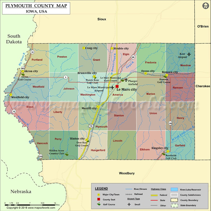
Plymouth County Map, Iowa
Airports in Plymouth County Airport Name Kerr Airport Le Mars Municipal Airport Plueger Airfield Cities in Plymouth County City Population Latitude Longitude Akron city 1486 42.82683 -96.557104 Brunsville city 151…
Airports in Plymouth County
Airport Name
Kerr Airport
Le Mars Municipal Airport
Plueger Airfield
Cities in Plymouth County
City
Population
Latitude
Longitude
Akron city
1486
42.82683
-96.557104
Brunsville city
151
42.810961
-96.266703
Craig city
89
42.895564
-96.309574
Hinton city
928
42.621298
-96.297475
Kingsley city
1411
42.586466
-95.967901
Le Mars city
9826
42.781018
-96.174182
Merrill city
755
42.720551
-96.252491
Oyens city
103
42.819811
-96.058076
Remsen city
1663
42.814619
-95.972603
Struble city
78
42.894467
-96.194585
Westfield city
132
42.756165
-96.605519
Golf Courses in Plymouth County
Name of Golf Course
Latitude
Longitude
Akron Golf Course-Akron
42.818503
-96.557204
Brookside Golf Club-Kingsley
42.580259
-95.985737
Deer Run Golf Course-Hinton
42.619646
-96.294745
Hidden Acres Country Club-Sioux City
42.578954
-96.379273
Le Mars Municipal Golf Course-Le Mars
42.800693
-96.153551
Prairie Rose Golf Club-Brunsville
42.809697
-96.265525
Remsen Golf Course-Remsen
42.811793
-95.979495

 Wall Maps